Category:Maps of municipalities in the canton of Fribourg to 2021
Jump to navigation
Jump to search
Media in category "Maps of municipalities in the canton of Fribourg to 2021"
The following 14 files are in this category, out of 14 total.
-
 Karte Bezirk Broye 2021 blank.png 2,066 × 1,505; 532 KB
-
 Karte Bezirk Broye 2021.png 2,066 × 1,505; 644 KB
-
 Karte Bezirk Glâne 2020 blank.png 2,066 × 1,659; 544 KB
-
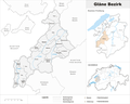 Karte Bezirk Glâne 2020.png 2,066 × 1,659; 657 KB
-
 Karte Bezirk Greyerz 2014.png 2,066 × 1,581; 901 KB
-
 Karte Bezirk Greyerz 2014 blank.png 1,476 × 1,130; 458 KB
-
 Karte Bezirk Saane 2021 blank.png 2,066 × 1,532; 573 KB
-
 Karte Bezirk Saane 2021.png 2,066 × 1,532; 687 KB
-
 Karte Bezirk See 2017 blank.png 2,066 × 1,483; 488 KB
-
 Karte Bezirk See 2017.png 2,066 × 1,483; 594 KB
-
 Karte Bezirk Sense 2021 blank.png 2,066 × 1,722; 521 KB
-
 Karte Bezirk Sense 2021.png 2,066 × 1,722; 633 KB
-
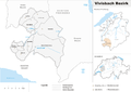 Karte Bezirk Vivisbach 2007.png 2,066 × 1,464; 677 KB
-
 Karte Bezirk Vivisbach 2007 blank.png 2,066 × 1,464; 546 KB


