Category:Maps of municipalities in the district of Greyerz to 2013
Jump to navigation
Jump to search
Media in category "Maps of municipalities in the district of Greyerz to 2013"
The following 27 files are in this category, out of 27 total.
-
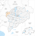
 Karte Gemeinden des Bezirks Greyerz 2011.png 1,476 × 1,519; 671 KB
-
 Karte Gemeinde Bas-Intyamon 2011.png 1,476 × 1,519; 673 KB
-
 Karte Gemeinde Botterens 2011.png 1,476 × 1,519; 671 KB
-
 Karte Gemeinde Broc 2011.png 1,476 × 1,519; 672 KB
-
 Karte Gemeinde Bulle 2011.png 1,476 × 1,519; 674 KB
-
 Karte Gemeinde Cerniat 2011.png 1,476 × 1,519; 673 KB
-
 Karte Gemeinde Charmey 2011.png 1,476 × 1,519; 674 KB
-
 Karte Gemeinde Châtel-sur-Montsalvens 2011.png 1,476 × 1,519; 671 KB
-
 Karte Gemeinde Corbières 2011.png 1,476 × 1,519; 672 KB
-
 Karte Gemeinde Crésuz 2011.png 1,476 × 1,519; 671 KB
-
 Karte Gemeinde Echarlens 2011.png 1,476 × 1,519; 672 KB
-
 Karte Gemeinde Grandvillard 2011.png 1,476 × 1,519; 672 KB
-
 Karte Gemeinde Gruyères 2011.png 1,476 × 1,519; 673 KB
-
 Karte Gemeinde Haut-Intyamon 2011.png 1,476 × 1,519; 673 KB
-
 Karte Gemeinde Hauteville 2011.png 1,476 × 1,519; 672 KB
-
 Karte Gemeinde Jaun 2011.png 1,476 × 1,519; 674 KB
-
 Karte Gemeinde La Roche 2011.png 1,476 × 1,519; 672 KB
-
 Karte Gemeinde Le Pâquier 2011.png 1,476 × 1,519; 672 KB
-
 Karte Gemeinde Marsens 2011.png 1,476 × 1,519; 672 KB
-
 Karte Gemeinde Morlon 2011.png 1,476 × 1,519; 671 KB
-
 Karte Gemeinde Pont-en-Ogoz 2011.png 1,476 × 1,519; 671 KB
-
 Karte Gemeinde Pont-la-Ville 2011.png 1,476 × 1,519; 671 KB
-
 Karte Gemeinde Riaz 2011.png 1,476 × 1,519; 672 KB
-
 Karte Gemeinde Sorens 2011.png 1,476 × 1,519; 672 KB
-
 Karte Gemeinde Sâles 2011.png 1,476 × 1,519; 672 KB
-
 Karte Gemeinde Vaulruz 2011.png 1,476 × 1,519; 672 KB
-
 Karte Gemeinde Vuadens 2011.png 1,476 × 1,519; 672 KB


