Category:Maps of municipalities in the district of Prättigau-Davos to 2015
Jump to navigation
Jump to search
Media in category "Maps of municipalities in the district of Prättigau-Davos to 2015"
The following 14 files are in this category, out of 14 total.
-
 Karte Gemeinden des Bezirks Prättigau-Davos 2011.png 1,476 × 1,419; 547 KB
-
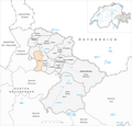
 Karte Gemeinde Conters im Prättigau 2011.png 1,476 × 1,419; 548 KB
-
 Karte Gemeinde Davos 2011.png 1,476 × 1,419; 550 KB
-
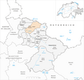
 Karte Gemeinde Fideris 2011.png 1,476 × 1,419; 548 KB
-
 Karte Gemeinde Furna 2011.png 1,476 × 1,419; 549 KB
-
 Karte Gemeinde Grüsch 2011.png 1,476 × 1,419; 549 KB
-
 Karte Gemeinde Jenaz 2011.png 1,476 × 1,419; 549 KB
-
 Karte Gemeinde Klosters-Serneus 2011.png 1,476 × 1,419; 550 KB
-
 Karte Gemeinde Küblis 2011.png 1,476 × 1,419; 548 KB
-
 Karte Gemeinde Luzein 2011.png 1,476 × 1,419; 549 KB
-
 Karte Gemeinde Saas im Prättigau 2011.png 1,476 × 1,419; 549 KB
-
 Karte Gemeinde Schiers 2011.png 1,476 × 1,419; 549 KB
-
 Karte Gemeinde Seewis im Prättigau 2011.png 1,476 × 1,419; 549 KB
-
 Karte Gemeinde St. Antönien 2011.png 1,476 × 1,419; 549 KB


