Category:Maps of municipalities in the district of Toggenburg
Jump to navigation
Jump to search
Subcategories
This category has the following 6 subcategories, out of 6 total.
2
Media in category "Maps of municipalities in the district of Toggenburg"
The following 11 files are in this category, out of 11 total.
-
 Karte Gemeinden des Wahlkreis Toggenburg 2023.png 1,476 × 1,386; 434 KB
-
 Karte Gemeinde Bütschwil-Ganterschwil 2023.png 1,476 × 1,386; 434 KB
-
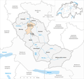
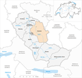
 Karte Gemeinde Ebnat-Kappel 2023.png 1,476 × 1,386; 435 KB
-
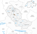
 Karte Gemeinde Kirchberg SG 2023.png 1,476 × 1,386; 434 KB
-
 Karte Gemeinde Lichtensteig 2023.png 1,476 × 1,386; 434 KB
-
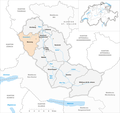
 Karte Gemeinde Lütisburg 2023.png 1,476 × 1,386; 434 KB
-
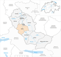
 Karte Gemeinde Mosnang 2023.png 1,476 × 1,386; 435 KB
-
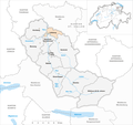
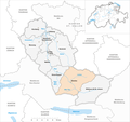
 Karte Gemeinde Neckertal 2023.png 1,476 × 1,386; 435 KB
-
 Karte Gemeinde Nesslau 2023.png 1,476 × 1,386; 435 KB
-
 Karte Gemeinde Wattwil 2023.png 1,476 × 1,386; 435 KB
-
 Karte Gemeinde Wildhaus-Alt St. Johann 2023.png 1,476 × 1,386; 435 KB


