Category:Maps of protected areas in Michigan
Jump to navigation
Jump to search
States of the United States: Alabama · Alaska · Arizona · Arkansas · California · Colorado · Florida · Georgia · Hawaii · Idaho · Illinois · Indiana · Iowa · Kansas · Kentucky · Louisiana · Maine · Maryland · Massachusetts · Michigan · Minnesota · Mississippi · Missouri · Montana · Nebraska · Nevada · New Hampshire · New Jersey · New Mexico · New York · North Carolina · Ohio · Oklahoma · Oregon · Pennsylvania · South Carolina · South Dakota · Tennessee · Texas · Utah · Vermont · Virginia · Washington · West Virginia · Wisconsin · Wyoming – Washington, D.C.
American Samoa · Puerto Rico · United States Virgin Islands
American Samoa · Puerto Rico · United States Virgin Islands
Subcategories
This category has the following 3 subcategories, out of 3 total.
I
Media in category "Maps of protected areas in Michigan"
The following 6 files are in this category, out of 6 total.
-
 A lake tour to picturesque Mackinac; historical and descriptive (1884) (14772759834).jpg 3,926 × 1,578; 1.31 MB
-
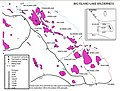 Big Island Lake Wilderness map.jpg 842 × 636; 215 KB
-
 Friendship park map 2019.01.03.pdf 1,275 × 1,650; 2.38 MB
-
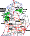 Huron Manistee USFS map.png 450 × 546; 18 KB
-
 MichiganNationalForests-zh.svg 549 × 606; 102 KB
-
 MichiganNationalForests.svg 549 × 606; 102 KB


_(14772759834).jpg)