Category:Maps of protected areas in Sarthe
Jump to navigation
Jump to search
Media in category "Maps of protected areas in Sarthe"
The following 5 files are in this category, out of 5 total.
-
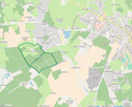
 MaraisCréLaFlèche.png 881 × 585; 95 KB
-
 Périmètre RNR Bas marais tourbeux de la basse Goulandière rnr230.png 994 × 815; 491 KB
-
 Périmètre RNR Coteau et plateau de Tessé rnr214.png 958 × 888; 209 KB
-
 Périmètre RNR Coteau et prairies des Caforts rnr215.png 958 × 886; 282 KB
-
 Périmètre RNR Prairies et roselière des Dureaux rnr166.png 998 × 819; 332 KB


