Category:Maps of provinces of Argentina
Jump to navigation
Jump to search
Subcategories
This category has the following 5 subcategories, out of 5 total.
*
Media in category "Maps of provinces of Argentina"
The following 30 files are in this category, out of 30 total.
-
 257px Blank Argentina Map.png 257 × 600; 23 KB
-
 Argentina - Map - Provinces with names He.png 456 × 776; 54 KB
-
 Argentina - Map - Provinces with names.png 456 × 776; 37 KB
-
 Argentina - Político (regiones).png 568 × 937; 23 KB
-
 Argentina - Político 2.png 568 × 937; 25 KB
-
 Argentina - Político.png 568 × 937; 19 KB
-
 Argentina blank.svg 525 × 1,015; 185 KB
-
 Argentina provinces blank 2.png 520 × 1,004; 17 KB
-
 Argentina provinces by population 2010.png 534 × 973; 34 KB
-
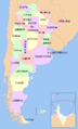
 Argentina provinces english.png 500 × 1,070; 36 KB
-
 Argentina provinces spanish.png 500 × 1,070; 36 KB
-
 Argentina provinces, blank.png 520 × 1,004; 13 KB
-
 Argentina provincias por poblacion.png 568 × 937; 43 KB
-
 Argentina wiki.png 568 × 937; 41 KB
-
 Argentina, administrative divisions - mk - colored (+claims).svg 1,418 × 2,412; 1.67 MB
-
 Argentine provinces by GDP (nominal) 2005.png 520 × 1,004; 30 KB
-
 Argentine provinces growing Torrontes.jpg 310 × 599; 26 KB
-
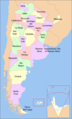 Map of Argentina with provinces names en.png 566 × 936; 28 KB
-
 Map of Argentina with provinces names es.png 566 × 936; 21 KB
-
 Map of Argentina with provinces.svg 568 × 937; 466 KB
-
 Map of the Provinces of Argentina zh.png 566 × 936; 57 KB
-
 Map of the Provinces of Argentina.png 566 × 936; 38 KB
-
 Map of the Provinces of Argentina.svg 1,418 × 2,412; 1.69 MB
-
 Mapa de Argentina (subdivisiones).svg 2,229 × 3,977; 5.08 MB
-
 Mapa de Argentina por departamentos.svg 283 × 600; 1.33 MB
-
 Mapa de las Provincias de Argentina - he B.svg 874 × 1,604; 808 KB
-
 Mapa de las Provincias de Argentina - he.svg 874 × 1,604; 683 KB
-
 Provincias de Argentina.png 260 × 502; 15 KB
-
 Región Centro de Argentina.png 568 × 937; 19 KB
-
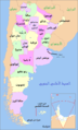 محافظات الأرجنتين.png 566 × 936; 56 KB


.png)


.svg)
_2005.png)


.svg)


