Category:Maps of reaches or the estuary of the River Thames
Jump to navigation
Jump to search
Subcategories
This category has only the following subcategory.
Media in category "Maps of reaches or the estuary of the River Thames"
The following 19 files are in this category, out of 19 total.
-
 Brentford and Lots Aits OS OpenData map.png 757 × 481; 57 KB
-
 Coalhouse Fort in Thames Estuary map.png 1,144 × 436; 10 KB
-
 Diamondflotillamap.svg 1,100 × 900; 34 KB
-
 Districts of thames gateway.png 810 × 419; 18 KB
-
 Final route of the SS Princess Alice.svg 2,189 × 985; 514 KB
-
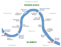 Head of the River Race Thames map.svg 800 × 626; 131 KB
-
 Hoo Peninsula.png 873 × 608; 58 KB
-
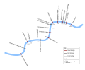
 London River Services map.svg 1,566 × 566; 49 KB
-
 Lower Thames Crossing route, November 2017.svg 574 × 728; 896 KB
-
 LtcApril2017.png 676 × 759; 777 KB
-
 Marchioness overview.png 1,511 × 1,073; 2.58 MB
-
 Old Navigation stream by Lighthouse.jpg 602 × 764; 57 KB
-
 Route of the Princess Alice.jpg 2,160 × 1,027; 1.05 MB
-
 Thames Estuary airports proposed locations SS Richard Montgomery.png 1,075 × 692; 318 KB
-
 Thames Estuary airports proposed locations.gif 1,075 × 692; 322 KB
-
 Thames Gateway bridge location.PNG 892 × 640; 897 KB
-
 Thames tunnels.svg 650 × 191; 15 KB
-
 Tidal Thames floodplain.png 2,339 × 1,654; 719 KB
-
 University Boat Race Thames map.svg 800 × 626; 313 KB


