Category:Maps of rifts
Jump to navigation
Jump to search
Media in category "Maps of rifts"
The following 21 files are in this category, out of 21 total.
-
 Antartica.jpg 1,293 × 1,080; 924 KB
-

-
 Atlantic Oceanic-Crust.jpg 600 × 600; 301 KB
-
 Baikal-1.png 536 × 376; 55 KB
-
 Beta Regio on Venus.jpg 452 × 818; 116 KB
-
 Capricorn Seamount-NOAA-Tectonic features hires (cropped).jpg 188 × 190; 75 KB
-
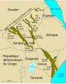 Central African Rifts-fr.svg 730 × 923; 70 KB
-
 Central African Rifts.svg 730 × 923; 57 KB
-
 GulfofSuezRift.png 2,217 × 2,885; 684 KB
-
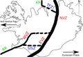
 Iceland Mid-Atlantic Ridge map IS.svg 376 × 390; 97 KB
-
 Iceland Mid-Atlantic Ridge map-de.svg 752 × 786; 106 KB
-
 Iceland Mid-Atlantic Ridge map.svg 376 × 390; 129 KB
-
 Japan separation.png 1,500 × 1,056; 3.32 MB
-
 Lau Basin-NOAA-Tectonic features hires.jpg 2,642 × 2,189; 4.65 MB
-
 Midcontinent Rift map.PNG 774 × 675; 55 KB
-
 MLIP igneous figures.png 510 × 403; 35 KB
-
 Newberry-Yellowstone tracks.png 536 × 326; 19 KB
-
 Okhotsk Plate map en.png 628 × 850; 40 KB
-
 Outline of Iceland Deformation Zone.png 702 × 480; 69 KB
-
 Richmond Basin Geological Diagram.jpg 2,151 × 2,050; 1.97 MB
-
 Siculo-Calabrian Rift.png 2,345 × 3,008; 1.35 MB

.png)


.jpg)


