Category:Maps of subdivisions of Austria-Hungary
Jump to navigation
Jump to search
Subcategories
This category has the following 17 subcategories, out of 17 total.
Media in category "Maps of subdivisions of Austria-Hungary"
The following 24 files are in this category, out of 24 total.
-
 Austria-Hungary map cs.svg 783 × 605; 250 KB
-
 Austria-Hungary map de.svg 783 × 605; 572 KB
-
 Austria-Hungary map ES.svg 783 × 605; 379 KB
-
 Austria-Hungary map HE.svg 783 × 605; 274 KB
-
 Austria-Hungary map Hebrew.svg 783 × 605; 213 KB
-
 Austria-Hungary map hr.svg 783 × 605; 334 KB
-
 Austria-Hungary map hu.svg 783 × 605; 316 KB
-
 Austria-Hungary map mk.svg 783 × 605; 412 KB
-
 Austria-Hungary map new-ar.svg 783 × 605; 294 KB
-
 Austria-Hungary map new.svg 783 × 605; 245 KB
-
 Austria-Hungary map ru.svg 783 × 605; 316 KB
-
 Austria-Hungary map sr.svg 783 × 605; 332 KB
-
 Austria-Hungary map ua.svg 783 × 605; 317 KB
-
 Austria-Hungary map with legend ES.svg 783 × 605; 344 KB
-
 Austria-Hungary map with legend2 es.svg 783 × 605; 381 KB
-
 Austria-Hungary map-pl.svg 783 × 605; 331 KB
-
 Austria-Hungary map-sl.svg 783 × 605; 332 KB
-
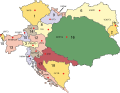
 Austria-Hungary map.svg 783 × 605; 331 KB
-
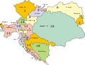
 AustriaHungary2.svg 783 × 605; 247 KB
-
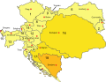
 AustriaHungary3.svg 783 × 605; 247 KB
-
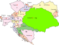
 AustriaHungary4.svg 783 × 605; 247 KB
-
 Kaiser-Franz-Josef-Museum 9907.jpg 3,095 × 2,289; 2.68 MB
-
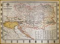
 Lange-Diercke Volksschulatlas (Östereich-Ungarn).jpg 2,978 × 1,688; 2.18 MB
-
 Map of the Austro-Hungarian Empire.jpg 3,512 × 2,943; 2.61 MB


.jpg)
