Category:Maps of subdivisions of British India
Jump to navigation
Jump to search
Subcategories
This category has the following 6 subcategories, out of 6 total.
A
P
Media in category "Maps of subdivisions of British India"
The following 17 files are in this category, out of 17 total.
-
 1946 Political Subdivisions of India by National Geographic.jpg 8,584 × 7,478; 3.18 MB
-
 1947-Khasi states.png 636 × 456; 13 KB
-
 AssamProvince1936 Map.png 2,000 × 2,060; 519 KB
-
 British India-es.svg 512 × 394; 849 KB
-
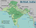
 British India.png 1,600 × 1,235; 680 KB
-
 British Indian Empire Imperial Gazetteer of India 1908 High Resolution.jpg 5,063 × 4,737; 11.62 MB
-
 British Raj-es.svg 1,201 × 1,007; 176 KB
-
 British Raj.svg 1,201 × 1,007; 221 KB
-
 India 1819-1909.svg 1,200 × 1,000; 790 KB
-
 Indian princely states gun salute.svg 1,827 × 1,771; 1.49 MB
-
 Khetri.png 720 × 836; 89 KB
-
 Map british india kipling en.svg 512 × 394; 156 KB
-
 Map british india kipling PL.svg 1,200 × 926; 408 KB
-
 Map british india kipling-hu.svg 1,193 × 918; 323 KB
-
 Map of British India anachronous.png 913 × 800; 359 KB
-
 On the trail of Kipling's Kim.png 2,994 × 2,327; 1.11 MB
-
 Political Divisions of the Indian Empire over British India and Indian states 1920.png 1,621 × 1,401; 305 KB


