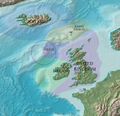
Category:Maps of territorial waters of the United Kingdom
Jump to navigation
Jump to search
Subcategories
This category has the following 2 subcategories, out of 2 total.
Media in category "Maps of territorial waters of the United Kingdom"
The following 10 files are in this category, out of 10 total.
-
Exclusive Economic Zones United Kingdom plus deps.png 2,410 × 1,178; 155 KB
-
Exclusive Economic Zones United Kingdom.png 2,410 × 1,178; 153 KB
-
Pacific boundery UK FR.svg 709 × 580; 51 KB
-
Rockall EEZ map-en.svg 1,904 × 2,509; 577 KB
-
Rockall EEZ map-fr.svg 1,904 × 2,509; 577 KB
-
Rockall EEZ topographic map-en.svg 1,904 × 2,509; 690 KB
-
Rockall EEZ topographic map-hy.svg 1,904 × 2,509; 691 KB
-
Rockall EEZ.jpg 864 × 832; 97 KB
-
Territorial waters - United Kingdom.svg 800 × 400; 728 KB
-
UK exclusive economic zone.jpg 1,384 × 1,823; 327 KB


