Category:Maps of the Almere or Flevo lake
Jump to navigation
Jump to search
Media in category "Maps of the Almere or Flevo lake"
The following 19 files are in this category, out of 19 total.
-
 - Topografische kaarten - 30032657 - RCE.jpg 526 × 1,200; 42 KB
-
 1865 Spruner Map FLEVVM.jpg 478 × 465; 282 KB
-
 500vc ex leg copy.jpg 510 × 616; 171 KB
-
 50nc ex leg copy.jpg 510 × 615; 177 KB
-
 800nc ex leg.jpg 510 × 613; 179 KB
-

-
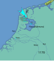 Allerheiligen1170.svg 749 × 840; 74 KB
-
 Almeremeer.png 290 × 340; 7 KB
-
 Belgii veteris typus (8345414951).jpg 800 × 679; 142 KB
-
 Bilderdijk 1000.jpg 1,455 × 1,545; 223 KB
-
 Creiler woud.jpg 600 × 647; 44 KB
-
 Flevomeer.gif 290 × 340; 5 KB
-
 Frisia 716-la.svg 583 × 602; 197 KB
-

-
 Nederland-50AD-af.svg 510 × 615; 71 KB
-
 North Holland 1st-10th Century.jpg 1,198 × 585; 643 KB
-
 Tuil nan Naomh Uile 1170-b.svg 749 × 840; 72 KB
-
 Tuil nan Naomh Uile 1170-c.svg 749 × 840; 71 KB
-
 Tuil nan Naomh Uile 1170.svg 749 × 840; 70 KB


.jpg)


_(14741857236).jpg)


