Category:Maps of the Arctic
Jump to navigation
Jump to search
Subcategories
This category has the following 18 subcategories, out of 18 total.
Media in category "Maps of the Arctic"
The following 97 files are in this category, out of 97 total.
-
301 of 'Den sidste Franklin-Expedition med “Fox,” Capt. McClintock' (11059488684).jpg 4,333 × 2,650; 2.14 MB
-
A map of the area Denmark is claiming.png 800 × 599; 305 KB
-
Admiralty Chart Catalogue 1967 Page 119 Index V.jpg 8,561 × 6,801; 9.51 MB
-
Alaska Ranger sinking site.jpeg 959 × 827; 38 KB
-
Andree expedition-fr.png 2,222 × 1,833; 813 KB
-
Andreeexpedition.png 2,222 × 1,833; 842 KB
-
Anwrmap.jpg 661 × 567; 176 KB
-
Arctic Alaska-Chukotka 0Ma.jpg 1,497 × 815; 364 KB
-
Arctic Alaska-Chukotka 100Ma.jpg 1,497 × 815; 267 KB
-
Arctic Alaska-Chukotka 150Ma.jpg 1,497 × 815; 251 KB
-
Arctic Alaska-Chukotka 50Ma.jpg 1,497 × 815; 328 KB
-
Arctic blank map.png 600 × 598; 76 KB
-
Arctic circle.png 1,406 × 1,759; 279 KB
-
Arctic hu.png 2,000 × 2,508; 2.17 MB
-
Arctic Ice Thickness - 2.png 640 × 480; 77 KB
-
Arctic Ocean relief location map he.png 591 × 591; 645 KB
-
Arctic Population Map.jpg 550 × 626; 240 KB
-
Arctic Region - DPLA - 2fff94d45fb98da9db647949bf8bafec.jpg 2,560 × 3,274; 6.23 MB
-
Arctic Region - DPLA - 364ffb1d8b951e65239e0fa4c38247c0 (page 1).jpg 2,554 × 3,272; 5.94 MB
-
Arctic Region - DPLA - 364ffb1d8b951e65239e0fa4c38247c0 (page 2).jpg 2,556 × 3,274; 6.02 MB
-
Arctic Region - DPLA - 691ffe9cc25456e971a895cf1ab3316c.jpg 2,552 × 3,274; 5.72 MB
-
Arctic Region - DPLA - 6f8c018cda18f9c03afbe1ffeb83a95c.jpg 2,556 × 3,282; 5.75 MB
-
Arctic Region - DPLA - b59f71808678ff337cd1aaa1b2f1b7a4.jpg 2,556 × 3,270; 6.88 MB
-
Arctic Region - DPLA - e0a2023317d691b720342acda9873fff.jpg 2,554 × 3,284; 6.32 MB
-
Arctic Region - DPLA - ffbae5587caa12175945887cc1b0dbc4.jpg 2,556 × 3,276; 6.78 MB
-
Arctic Sea Ice Continues Decline, Hits 2nd-Lowest Level.jpg 1,280 × 720; 84 KB
-
Arctic SSMI1979-03.jpg 540 × 713; 125 KB
-
Arctic tides (1911) (14762958892).jpg 2,632 × 3,700; 3.4 MB
-
ArcticColdWarStations.png 950 × 1,056; 1.71 MB
-
ArcticLocationMap2.png 525 × 488; 75 KB
-
ArcticSeaIce.png 837 × 992; 1.44 MB
-
ArcticTemperatures.png 1,000 × 549; 1.11 MB
-
Arktis Bodenschätze.gif 538 × 435; 127 KB
-
Bering Strait depth.gif 526 × 350; 21 KB
-
Calidris alba Breeding area.jpg 300 × 275; 32 KB
-
Cambios en la capa de hielo de Groenlandia.jpg 540 × 450; 56 KB
-
Caribou calving map.jpg 490 × 236; 46 KB
-
Caribou herd ranges.jpg 490 × 226; 64 KB
-
Carte de l'Arctique et des mers nordiques.png 1,085 × 1,085; 327 KB
-
Circumpolar coastal human population distribution ca. 2009.png 881 × 942; 567 KB
-
Course 1903 copy.jpg 624 × 836; 352 KB
-
D041- Avancée des glaces-L1-Ch1.png 1,800 × 2,328; 599 KB
-
D059-Densité de la population arctique-L1-Ch2.png 1,777 × 2,326; 614 KB
-
Discovery (20773725718).jpg 1,998 × 1,918; 515 KB
-
ECDM 20210308 Arctic ForestFires Emissions(1).pdf 1,625 × 1,125; 674 KB
-
ECDM 20211119 Arctic ForestFires Emissions.pdf 1,625 × 1,125; 800 KB
-
ECDM 20220915 Arctic Forest fires.pdf 1,625 × 1,125; 794 KB
-
Expedition Fyodor Konyukhov and Victor Simonov.png 4,555 × 3,888; 10.3 MB
-
Explorers Map, 1914, Stephen Leacock.jpg 3,063 × 1,887; 1.57 MB
-
FranzJosefLand1.gif 350 × 306; 119 KB
-
Globe showing Arctic 2.png 600 × 600; 98 KB
-
Globe showing Arctic.png 500 × 500; 50 KB
-
Hann Atlas der Meteorologie 2.jpg 1,180 × 975; 367 KB
-
IICWG Arctic Chart 2007 H.gif 767 × 777; 489 KB
-
Im map.webp 2,000 × 2,000; 154 KB
-
Index - Operational Navigation Chart - Arctic.png 834 × 830; 402 KB
-
Inuit conf map.png 500 × 500; 203 KB
-
Ipy-bossekop-map.jpg 2,758 × 2,404; 995 KB
-
Journal.pone.0082306.g006.png 2,049 × 2,652; 4.62 MB
-
Karte der reise Jan Cornelisz May vom Eismeer zur Amerikanischen Kueste 1611-1612.jpg 4,078 × 2,294; 784 KB
-
Karte Nordwestpassage und Nordostpassage.png 1,152 × 1,152; 469 KB
-
Major Research Stations in the Arctic.jpg 2,160 × 2,153; 722 KB
-
Map of Arctic shipping accidents and incidents causes, 1995-2004.png 932 × 1,140; 888 KB
-
Map of the Arctic.jpg 3,571 × 2,934; 2.32 MB
-
MGRSgridNorthPole.png 1,846 × 1,372; 1.54 MB
-
Midnight sun dates svatlas.png 1,700 × 3,065; 113 KB
-
Nansen Fram Map rus.png 1,003 × 601; 84 KB
-
Nansen Fram Map.png 800 × 479; 195 KB
-
NASA Arctic Temperature Change 1981-2007.png 358 × 403; 223 KB
-
Nordostpassage NASA Worldwind-globe.png 900 × 900; 1.04 MB
-
Nordwestpassage NASA Worldwind-globe.png 900 × 900; 938 KB
-
North pole map.jpeg 1,200 × 1,278; 1,022 KB
-
Northwest passage.jpg 2,560 × 960; 1.02 MB
-
Nunavut 4N531B.jpg 1,600 × 1,382; 344 KB
-
Occurrence of Primula veris.jpg 800 × 800; 117 KB
-
Orthographic projection over Kirkenes Norway.png 488 × 487; 20 KB
-
Orthographic projection over Svalbard.png 488 × 487; 20 KB
-
Panel 1 - European Arctic.jpg 3,978 × 2,868; 1.13 MB
-
PAT - Arctic region.gif 1,680 × 2,000; 933 KB
-
Polar geographic expeditions of the United States.jpg 4,169 × 2,820; 2.33 MB
-
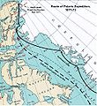
Polaris Expedition route.jpg 524 × 570; 295 KB
-
Political Map of the Arctic.pdf 4,770 × 3,639; 11.48 MB
-
Route der ersten deutsche Arktisexpedition.png 1,525 × 2,125; 1.72 MB
-
Russian Arctic claim.PNG 593 × 599; 561 KB
-
Russian claim arctic.jpg 588 × 362; 39 KB
-
Top of the World, 1949.jpg 2,964 × 3,072; 4.6 MB
-
World map with arctic circle.jpg 3,630 × 1,870; 1.33 MB
-
Xplanet polar ortho.jpg 400 × 400; 48 KB
-
Xq-map.png 329 × 330; 14 KB
-
Зеленый пояс Фенноскандии.jpg 1,007 × 581; 182 KB
-
Реки Таймыра, названные Константином Петровым hu.png 2,355 × 2,731; 1.35 MB


