Category:Maps of the Arctic sea ice
Jump to navigation
Jump to search
Subcategories
This category has only the following subcategory.
M
Media in category "Maps of the Arctic sea ice"
The following 17 files are in this category, out of 17 total.
-
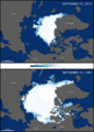
 2013 ARCTIC SEA ICE MINIMUM.jpg 720 × 480; 171 KB
-
 Arctic ice March 1946 20%.jpg 9,375 × 9,200; 3.24 MB
-
 Arctic ice October 1946 20%.jpg 9,375 × 9,200; 3.36 MB
-
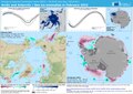
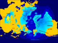
 Arctic ocean SST and ice edge.png 1,719 × 1,768; 1.15 MB
-
 Arctic sea ice extent in 2013 - maximum and minimum ice extents.png 810 × 581; 356 KB
-
 Arctic Sea Ice Minimum Comparison.png 720 × 1,005; 226 KB
-
AtCan Globe.webm 48 s, 925 × 925; 66.8 MB
-
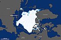
 Desglaç artic.svg 807 × 1,026; 126 KB
-
 ECDM 20220330 Arctic and Antarctic sea ice cover February 2022.pdf 2,479 × 1,754; 753 KB
-

-
-
 Ghiaccio artide 2012.png 2,920 × 1,740; 451 KB
-
 No-nb bldsa q3e006.jpg 5,105 × 4,576; 5.44 MB
-
 North pole february ice-pack 1978-2002.png 976 × 974; 98 KB
-
 North pole september ice-pack 1978-2002.png 488 × 487; 27 KB
-
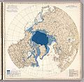
 Northern icesheet-fr.png 2,236 × 1,640; 402 KB
-
 Sea-ice-2013-en.svg 1,200 × 1,201; 2.05 MB


.jpg)


