Category:Maps of the Borough of Kettering
Jump to navigation
Jump to search
English: Maps of the former Kettering district, now in North Northamptonshire district, in the ceremonial county of Northamptonshire, England.
Media in category "Maps of the Borough of Kettering"
The following 30 files are in this category, out of 30 total.
-
 Kettering UK local election 2007 map.svg 1,206 × 1,266; 372 KB
-
 Kettering UK local election 2011 map.svg 1,206 × 1,266; 372 KB
-
 Kettering UK local election 2015 map.svg 1,206 × 1,266; 372 KB
-
 Kettering UK locator map.svg 1,106 × 1,266; 995 KB
-
 Kettering UK ward map 2010 (blank).svg 1,206 × 1,266; 371 KB
-
 Kettering unparished area UK locator map.svg 1,206 × 1,266; 447 KB
-
 KetteringBC2003dissolution.png 636 × 741; 13 KB
-
 KetteringBCAllSaints.png 636 × 741; 13 KB
-
 KetteringBCAvondaleGrange.png 636 × 741; 13 KB
-
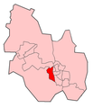
 KetteringBCBarton.png 636 × 741; 13 KB
-
 KetteringBCBrambleside.png 636 × 741; 13 KB
-
 KetteringBCBurtonLatimer.png 636 × 741; 13 KB
-
 KetteringBCDesborough Loatland.png 636 × 741; 21 KB
-
 KetteringBCDesboroughLoatland.png 636 × 741; 13 KB
-
 KetteringBCDesboroughStGiles.png 636 × 741; 13 KB
-
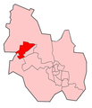
 KetteringBCIseLodge.png 636 × 741; 13 KB
-
 KetteringBCNorthfield.png 636 × 741; 13 KB
-
 KetteringBCPipersHill.png 636 × 741; 13 KB
-
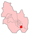
 KetteringBCpolitical.png 636 × 741; 13 KB
-
 KetteringBCQueenEleanorBuccleuch.png 636 × 741; 12 KB
-
 KetteringBCRothwell.png 636 × 741; 13 KB
-
 KetteringBCSlade.png 636 × 741; 13 KB
-
 KetteringBCSpinney.png 636 × 741; 21 KB
-
 KetteringBCStMichaelsWicksteed.png 636 × 741; 13 KB
-
 KetteringBCStPeters.png 636 × 741; 13 KB
-
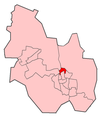
 KetteringBCwardmap.png 636 × 741; 18 KB
-
 KetteringBCWelland.png 636 × 741; 13 KB
-
 KetteringBCWicksteed.png 636 × 741; 21 KB
-
 KetteringBCWilliamKnibb.png 636 × 741; 13 KB
-
 NorthamptonshireKettering.png 200 × 222; 14 KB


.svg)