Category:Maps of the Chatham Islands
Jump to navigation
Jump to search
Subcategories
This category has the following 2 subcategories, out of 2 total.
Media in category "Maps of the Chatham Islands"
The following 9 files are in this category, out of 9 total.
-
Chatham Islands C.PNG 289 × 375; 27 KB
-
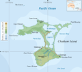
Chatham-Island map topo en.png 1,109 × 972; 139 KB
-
Chatham-Islands map topo be.png 1,670 × 1,425; 244 KB
-
Chatham-Islands map topo de.svg 1,669 × 1,425; 665 KB
-
Chatham-Islands map topo en.svg 1,669 × 1,425; 758 KB
-
Chatham-Islands map topo-fr.svg 1,669 × 1,425; 746 KB
-
Chatham-Islands map topo-mk.svg 1,669 × 1,425; 1.3 MB
-
Geological sketch map of the Chatham Islands.jpg 1,056 × 1,737; 180 KB
-
Pitt-Island map topo en.png 838 × 620; 70 KB


