Category:Maps of the Dutch East India Company - St Helena
Jump to navigation
Jump to search
Media in category "Maps of the Dutch East India Company - St Helena"
The following 8 files are in this category, out of 8 total.
-
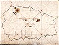 AMH-5208-NA Map of the island of St. Helena.jpg 2,400 × 1,840; 679 KB
-
 AMH-6599-KB View of the island of St Helena.jpg 2,400 × 1,835; 1.05 MB
-
 AMH-6658-KB Map of the island of St Helena.jpg 2,400 × 1,873; 1.28 MB
-
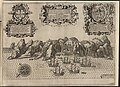
 AMH-6870-KB Bird's eye view of St. Helena.jpg 2,400 × 1,903; 1.17 MB
-
 AMH-7979-KB Map of St Helena's bay.jpg 1,803 × 2,400; 537 KB
-

-
-
 Saint Helena Island images 1596.jpg 2,273 × 1,500; 1.03 MB


