Category:Maps of the Egyptian second intermediate period
Jump to navigation
Jump to search
This category contains Maps of the Egyptian second intermediate period, covering the time between circa 1782 BCE and circa 1570 BCE in Ancient Egypt, namely the 13st to 17th dynasty.
Media in category "Maps of the Egyptian second intermediate period"
The following 12 files are in this category, out of 12 total.
-
 Abydos Dynasty.png 1,087 × 1,905; 256 KB
-
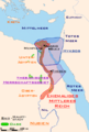
 Alter Orient 1600BC.svg 2,102 × 1,510; 5.06 MB
-
 Alter Orient 1700BC-es.svg 2,102 × 1,510; 3.5 MB
-
 Alter Orient 1700BC.svg 2,102 × 1,510; 4.69 MB
-
 Ancient Near East 1600BC.svg 2,102 × 1,510; 5.04 MB
-
 Ancient Near East 1700BC.svg 2,102 × 1,510; 4.69 MB
-
 Egypt Hyksos Period-gr.png 1,578 × 3,220; 461 KB
-
 Egypt Hyksos Period.png 1,578 × 3,220; 463 KB
-
 Egypt-din16-en.svg 1,577 × 3,219; 266 KB
-
 Egypt-din16-es.svg 1,577 × 3,219; 347 KB
-
 Egypt-din16-pt.svg 1,577 × 3,219; 261 KB
-
 Zweite Zwischenzeit.png 463 × 687; 78 KB


