Category:Maps of the Firth of Lorn
Jump to navigation
Jump to search
Media in category "Maps of the Firth of Lorn"
The following 16 files are in this category, out of 16 total.
-

-
 Admiralty Chart No 1790 Oban and Approaches, Published 1968.jpg 11,284 × 16,329; 31.64 MB
-
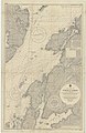
 Admiralty Chart No 2326 Loch Crinan to the Firth of Lorne (5413X8102), Published 1959.jpg 5,413 × 8,102; 14.28 MB
-
 Admiralty Chart No 2326 Loch Crinan to the Firth of Lorne, Published 1959.jpg 6,774 × 9,906; 25.95 MB
-
 Admiralty Chart No 2476 Firth of Lorne, Published 1953.jpg 11,291 × 17,675; 32.22 MB
-
 Admiralty Chart No 2476 Frith of Lorn, Published 1856.jpg 8,269 × 14,016; 16.45 MB
-
 Admiralty Chart No 2476 Frith of Lorn, Published 1910.jpg 8,132 × 14,033; 12.28 MB
-
-
 Admiralty Chart No 2724 Approaches to the Firth of Clyde, Published 1970.jpg 11,280 × 16,334; 22.32 MB
-
 Admiralty Chart No 3607 Sound of Mull Eastern Portion, Published 1907.jpg 16,335 × 11,229; 17.75 MB
-
 Blaeu - Atlas of Scotland 1654 - LORNA - The Firth of Lorn.jpg 6,333 × 4,725; 6.15 MB
-
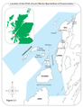 Firth of Lorn Special Area of Conservation Map.png 2,775 × 3,610; 735 KB
-
 Firth of Lorn.png 623 × 682; 100 KB
-
 FirthofLornmap.png 538 × 573; 17 KB
-
 Scotland Map (Firth of Lorn Detail) Loch Leven.png 250 × 158; 13 KB
-
 Scotland Map (Firth of Lorn Detail) Loch Linnhe.png 250 × 158; 14 KB
t(h)_the_Yles_and_provinces_bordering_there-upon_-_Auct._Timoth._Pont%22_(22071147560).jpg)

,_Published_1959.jpg)


_Loch_Leven.png)
_Loch_Linnhe.png)