Category:Maps of the Franciscan Cadaster of Silesia
Jump to navigation
Jump to search
Čeština: Katastrální mapy Slezska v měřítku 1:2880 pořizované v rámci Stabilního katastru (Franziszeische Kataster) ve 20. až 40. letech 19. století na základě patentu císaře Františka I. z 23. prosince 1817.
Media in category "Maps of the Franciscan Cadaster of Silesia"
This category contains only the following file.
-
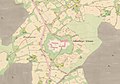 Jablunkovske sance cio 1836.jpg 1,110 × 779; 139 KB
