Category:Maps of the Gulf of İzmir
Jump to navigation
Jump to search
Wikimedia category | |||||
| Upload media | |||||
| Instance of | |||||
|---|---|---|---|---|---|
| Category combines topics | |||||
| Gulf of İzmir | |||||
gulf of the Aegean Sea  | |||||
| Instance of | |||||
| Part of | |||||
| Named after | |||||
| Location | İzmir Province, Turkey | ||||
| Has part(s) |
| ||||
| Inflows | |||||
 | |||||
Media in category "Maps of the Gulf of İzmir"
The following 19 files are in this category, out of 19 total.
-
 Admiralty Chart No 1521 Ports in the Gulf of Smyrna (Izmir) RMG L6253, Published 1844.tiff 4,800 × 3,823; 52.5 MB
-
 Admiralty Chart No 1521 Ports In The Gulf Of Smyrna (Izmir), Published 1844.jpg 7,616 × 6,130; 14.6 MB
-
 Admiralty Chart No 1522 Smyna (Izmir) Harbour, Turkey, Published 1860.jpg 12,448 × 8,477; 12.32 MB
-

-
 Admiralty Chart No 1645 Nisos Khios and Izmir Korfezi, Published 1967.jpg 16,850 × 11,379; 24.98 MB
-
 Archipelagusche Eylanden - by Iohannis van Keulen - btv1b53052811b.jpg 7,534 × 6,390; 7.04 MB
-
 Baye de Smyrne - Tournefort Joseph Pitton De - 1717.jpg 1,500 × 966; 653 KB
-
 Ca. 1717 van Keulen chart of the Aegean Sea and the Sea of Marmara.jpg 8,000 × 3,782; 9.41 MB
-
 Ca. 1730 map of North Eastern Greece and the Aegean by Johannes van Keulen.jpg 4,871 × 4,121; 4.07 MB
-

-

-
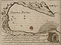
 De Golf van Smirne - Dapper Olfert - 1688.jpg 800 × 620; 216 KB
-

-
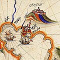 Izmir by Piri Reis (cropped).jpg 173 × 173; 24 KB
-
 Izmir by Piri Reis.jpg 586 × 825; 194 KB
-
 Izmir turkey.jpg 639 × 639; 167 KB
-
 Kitab-i Bahriye izmir.jpg 1,224 × 1,632; 289 KB
-
 Map of the port of Smyrna - Wheler George - 1682.jpg 800 × 591; 180 KB
-
 Pauly-Wissowa III A,1, 0747 Map Smyrna.png 993 × 739; 443 KB
,_Published_1844.jpg)
_Harbour,_Turkey,_Published_1860.jpg)
_and_Gulf_of_Smyrna_(%C4%B0zmir),_Published_1893.jpg)


_(14577407758).jpg)
.jpg)


