Category:Maps of the Ilhas Selvagens
Jump to navigation
Jump to search
Media in category "Maps of the Ilhas Selvagens"
The following 24 files are in this category, out of 24 total.
-
 IMRAY(1884) p0129 SALVAGE ISLANDS.jpg 3,633 × 2,703; 3.57 MB
-
 Admiralty Chart No 365 Ilheus Selvagem, Published 1942.jpg 11,268 × 16,422; 31.72 MB
-
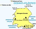 Ilha Selvagem Grande.jpg 1,010 × 814; 86 KB
-
 Ilhas Selvagens location distances.svg 7,706 × 9,839; 217 KB
-
 Ilhas Selvagens location.svg 7,706 × 9,839; 160 KB
-
 Ilhéu Alto location map.svg 998 × 1,455; 74 KB
-
 Ilhéu Comprido (Selvagens) location map.svg 998 × 1,455; 73 KB
-
 Ilhéu de Fora (Selvagens) location map.svg 998 × 1,455; 73 KB
-
 Ilhéu do Sul location map.svg 998 × 1,455; 74 KB
-
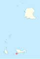 Ilhéu Grande location map.svg 998 × 1,455; 74 KB
-
 Ilhéu Pequeno location map.svg 998 × 1,455; 74 KB
-
 Ilhéu Redondo location map.svg 998 × 1,455; 74 KB
-
 Ilhéu Sinho location map.svg 998 × 1,455; 74 KB
-
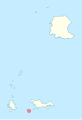
 Ilhéus do Norte location map.svg 998 × 1,455; 73 KB
-
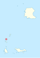
 Islas Selvagens location map.svg 998 × 1,455; 73 KB
-
 Islas Selvagens map be.png 998 × 1,455; 89 KB
-
 Islas Selvagens.svg 998 × 1,455; 520 KB
-
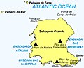
 Palheiro da Terra.svg 998 × 1,455; 74 KB
-
 Palheiro do Mar.svg 998 × 1,455; 74 KB
-
 PT Selvagens.PNG 500 × 413; 7 KB
-
 Selvagem Grande Island.jpg 1,010 × 814; 85 KB
-
 Selvagem Grande location map.svg 998 × 1,455; 73 KB
-
 Selvagem Pequena location map.svg 998 × 1,455; 73 KB
-
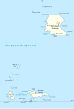
 Selvagens.png 1,000 × 1,452; 132 KB
_p0129_SALVAGE_ISLANDS.jpg)


_location_map.svg)
_location_map.svg)


