Category:Maps of the Inner Eastern Carpathians
Jump to navigation
Jump to search
- Maps of the Inner Eastern Carpathians, the inner section of Eastern Carpathian Mountains.
Media in category "Maps of the Inner Eastern Carpathians"
The following 18 files are in this category, out of 18 total.
-
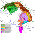
 Carpathians division.svg 640 × 486; 94 KB
-
 Carpathians Eastern Inner.svg 640 × 486; 96 KB
-
 Carpathians Eastern.svg 640 × 486; 96 KB
-
 Divisions of the Carpathians.png 2,011 × 1,906; 271 KB
-
 Map of Ukraine political Karpatskyi raion.png 800 × 559; 161 KB
-
 Mapa Marmaroszy.png 904 × 981; 1.19 MB
-
 Mapcarpat.png 442 × 395; 8 KB
-
 Mapcarpat2.png 442 × 395; 11 KB
-

-

-
 Ostkarpaten Skizze Gliederung.jpg 743 × 983; 170 KB
-
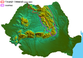 Romania-Eastern Carpathians.png 1,006 × 714; 805 KB
-
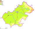 SM County Blank Map.gif 290 × 235; 5 KB
-
 Vihorlatské vrchy.jpg 1,661 × 845; 155 KB
-
 Vihorlatské vrchy.png 1,660 × 845; 63 KB
-
 Закарпатская область.png 1,200 × 900; 770 KB
-
 Украинские Карпаты.png 1,500 × 1,275; 1.21 MB
-
 Физическая карта Северо-Восточных Внешних Карпат.png 2,422 × 1,695; 6.46 MB


