Category:Maps of the Landkreis Südliche Weinstraße
Jump to navigation
Jump to search
Subcategories
This category has only the following subcategory.
Media in category "Maps of the Landkreis Südliche Weinstraße"
The following 15 files are in this category, out of 15 total.
-
 Germany.District.Südliche Weinstraße.Map.PNG 922 × 452; 5 KB
-
 Karte Landkreis Südliche Weinstraße.png 754 × 800; 137 KB
-
 Karte Landkreis Südliche Weinstraße.svg 437 × 464; 140 KB
-
 Karte Verbandsgemeinde Annweiler am Trifels.png 936 × 1,000; 157 KB
-
 Karte Verbandsgemeinde Bad Bergzabern.png 936 × 1,000; 156 KB
-
 Karte Verbandsgemeinde Edenkoben.png 936 × 1,000; 157 KB
-
 Karte Verbandsgemeinde Herxheim.png 936 × 1,000; 156 KB
-
 Karte Verbandsgemeinde Landau-Land.png 936 × 1,000; 157 KB
-
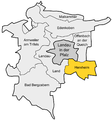
 Karte Verbandsgemeinde Maikammer.png 936 × 1,000; 156 KB
-
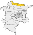
 Karte Verbandsgemeinde Offenbach an der Queich.png 936 × 1,000; 157 KB
-
 Lage des Landkreises Südliche Weinstraße in Deutschland.png 197 × 235; 3 KB
-
 Locator map SÜW in Germany.svg 1,075 × 1,273; 513 KB
-
 Locator map SÜW in Rhineland-Palatinate.svg 708 × 913; 627 KB
-
 Rhineland p suew.png 419 × 503; 13 KB
-
 SÜW in Rheinland-Pfalz.svg 574 × 744; 133 KB


