Category:Maps of the Mississippi River
Jump to navigation
Jump to search
English: Maps of the Mississippi River — in the United States.
Subcategories
This category has the following 4 subcategories, out of 4 total.
Media in category "Maps of the Mississippi River"
The following 115 files are in this category, out of 115 total.
-
 "Port Hudson and its Defenses.".jpg 4,415 × 6,052; 8.75 MB
-
 "Vicksburg and its Defenses." (cropped).jpg 3,823 × 4,793; 7.06 MB
-
 "Vicksburg and its Defenses.".jpg 4,415 × 6,052; 9.3 MB
-
 1721 Map of the new part of French Louisiana.jpg 8,104 × 6,291; 14.19 MB
-
-

-

-

-
 1986 Design Flows.gif 1,000 × 1,388; 54 KB
-

-

-
-
 479px-Mississippi Embayment shaded-relief 1.jpg 479 × 599; 88 KB
-
 A history of Louisiana (1904) (14761504534).jpg 3,488 × 2,150; 1.35 MB
-
 A new map of the River Mississipi from the sea to Bayagoulas (2673862061).jpg 2,000 × 1,517; 2.81 MB
-

-
 A plan of the several villages in the illinois country (cropped).png 512 × 332; 31 KB
-
 A plan of the several villages in the illinois country.png 1,196 × 1,996; 174 KB
-

-

-
 AngolaBigTopo (cropped).PNG 1,024 × 1,280; 1.78 MB
-
 AngolaBigTopo.PNG 2,772 × 2,238; 10.43 MB
-
 Applied sedimentation (1950) (19123942584).jpg 1,324 × 2,782; 1.53 MB
-

-
 Approximate Geographic Extent of Havana Hopewell.pdf 1,275 × 1,650; 14.29 MB
-
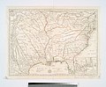
 Archives nationales d’outre-mer - Louisiane - Jacques-Nicolas Bellin - 1744 - 001.jpg 5,262 × 3,921; 3.73 MB
-
 Atchafalaya River.png 254 × 250; 7 KB
-
 Birds Point-New Madrid Flow.jpg 2,000 × 1,363; 274 KB
-
 Bulletin - Biological Survey (1888) (14784543683).jpg 1,540 × 3,164; 1.12 MB
-
 CapeRiverFrontPark1.JPG 3,264 × 2,448; 1.53 MB
-
 Carte de la rivière de Mississipi.png 937 × 600; 987 KB
-

-
 Chart of the Mississippi River from the Ohio river to Gulf of Mexico.".jpg 3,989 × 6,029; 8.23 MB
-

-
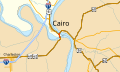
 Comparative Map of the Mississippi River in the Vicinity of Cairo - NARA - 128215804.jpg 9,780 × 7,878; 9.05 MB
-
 Delta Regional Authority Service Area.jpg 933 × 1,043; 242 KB
-
 DSC05722 (21895436759).jpg 5,456 × 3,632; 5.69 MB
-
 Embouchure du Mississippi - passage de l'Union en 1862.jpg 624 × 458; 108 KB
-
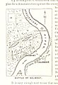
 Fort Pillow State Park TN 09 museum map Defense of the Mississippi.jpg 1,024 × 1,365; 912 KB
-
 Great River Road - Chucalissa Great River Road Sign - NARA - 7718890.jpg 2,200 × 3,300; 5.37 MB
-
 HUC07.jpg 640 × 434; 237 KB
-
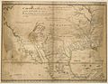
 Jean Baptiste Poirson - Mississippi, Louisiane, les 2 Florides, 1803.jpg 1,024 × 1,359; 408 KB
-
 Kaskaskia IL and vicinity USGS topo map.jpg 631 × 443; 155 KB
-
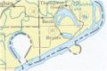
 Kentucky Bend map.png 720 × 720; 31 KB
-
 Kentucky Bend.png 902 × 768; 470 KB
-
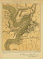
 Lloyd's map of the lower Mississippi River (map no. 3).jpg 3,063 × 11,754; 24.15 MB
-
 Lower Mississippi Delta Region.gif 255 × 304; 5 KB
-
-
 Map of the alluvial region of the Mississippi LOC 2015591011.jpg 5,707 × 8,850; 7.08 MB
-
-

-
 Meanders-Mississippi-maps-01 (cropped).jpg 929 × 1,163; 577 KB
-
 Meanders-Mississippi-maps-01.jpg 1,400 × 2,022; 1.28 MB
-
 Mississippi Alluvial Plain ecoregion map.png 2,550 × 3,300; 1.68 MB
-
 Mississippi bassin fr.png 1,465 × 958; 244 KB
-
 Mississippi Delta Lobes.jpg 800 × 484; 73 KB
-
 Mississippi Embayment relief map 2.svg 474 × 914; 8.97 MB
-
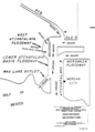
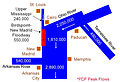
 Mississippi Project Design Flood.tif 1,502 × 1,127; 727 KB
-
 Mississippi River (ASTER).jpg 2,616 × 3,751; 3.41 MB
-
 Mississippi River flow.gif 774 × 1,000; 48 KB
-

-

-
 Mississippi RIver From source to Delta.jpg 863 × 26,410; 4.31 MB
-
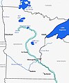 Mississippi River in MN.jpg 1,394 × 1,676; 214 KB
-
 Mississippi River levee map.gif 1,117 × 2,055; 200 KB
-
 Mississippi River locator map.png 2,144 × 1,524; 721 KB
-
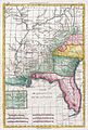
 Mississippi River map.png 1,386 × 870; 47 KB
-
 Mississippi river map.png 1,326 × 838; 2.05 MB
-
 Mississippi River mayfly hatch on radar.png 700 × 669; 748 KB
-
 Mississippi River mod.png 395 × 840; 14 KB
-
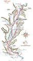
 Mississippi River Sources 1834.jpg 1,587 × 1,526; 409 KB
-
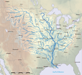
 Mississippi River Watershed Map North America.png 800 × 494; 260 KB
-
 Mississippi River Watershed Map.jpg 800 × 494; 119 KB
-
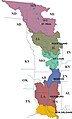 Mississippi Valley Division US Army Corps of Engineers Districts Map.jpg 476 × 786; 141 KB
-
 Mississippi watershed map 1.jpg 717 × 563; 130 KB
-
 Mississippi-map He.png 400 × 300; 71 KB
-
 Mississippi-map.gif 400 × 300; 31 KB
-
 Mississippi-map.png 400 × 300; 41 KB
-
 Mississippi-River-(PSF).png 2,337 × 1,758; 186 KB
-
 Mississippi17.bmp.png 1,186 × 776; 185 KB
-
 Mississippiriver-new-01.png 4,167 × 3,819; 5.33 MB
-
 Mississippirivermapnew.jpg 1,177 × 868; 199 KB
-
 New Madrid and Wabash seizmic zones-USGS.png 748 × 819; 467 KB
-
 New Madrid quakes.png 300 × 351; 82 KB
-
 New Madrid Seismic Zone activity 1974-2011.svg 747 × 788; 1.73 MB
-
 NMSZ Vergleich.jpg 437 × 281; 37 KB
-
 NSRW Work Done by our River Giant.jpg 1,566 × 1,893; 1.44 MB
-
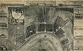
 1863 map- Plan of New Orleans (NYPL b13663520-1510812) (cropped).tiff 4,331 × 3,466; 43.61 MB
-
 Plan of New Orleans (NYPL b13663520-1510812).tiff 6,298 × 5,246; 95.18 MB
-
-
 Oxbow lake.jpg 250 × 166; 15 KB
-
-
 Plan and Profiles of the Fort St.Léon at the English turn - NARA - 102279859.jpg 6,203 × 4,968; 3.07 MB
-

-
-

-
 Périple de Huckleberry Finn sur le Mississippi.png 1,116 × 1,308; 131 KB
-
-
 Ribbon map of the (Fa)ther of Waters. LOC 86691596.tif 1,038 × 39,692; 117.88 MB
-
 River Walk P9140364.JPG 640 × 480; 59 KB
-
 Riverfront Exhibit P7280467 map of old and modern rivers.JPG 1,585 × 1,138; 252 KB
-
 The appeal to arms, 1861-1863 (1907) (14761344941).jpg 1,986 × 3,296; 1.33 MB
-
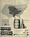
 The Commercial and financial chronicle (1911) (14778989871).jpg 4,232 × 2,464; 2.11 MB
-

-
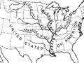
 Upper Mississippi 1812.png 816 × 1,056; 68 KB
-
 Upper Mississippi locks expansion study.jpeg 1,200 × 1,278; 551 KB
-
 Upper Mississippi River Valley AVA.png 415 × 500; 100 KB
-
 Upper Mississippi.png 500 × 541; 249 KB
-
 US 60-62 IL map.svg 1,026 × 608; 181 KB
-
 USGS Landscape landloss WetlandLoss Red Louisiana.jpg 1,000 × 333; 160 KB
-
 Vicksburg in 1865 map detail, from- "Vicksburg and its Defenses." (cropped).jpg 2,686 × 3,348; 3.66 MB
-

-
 Vue de la colonie espagnole du Mississippi en 1802 - carte reduite Haute Louisiane.jpg 1,059 × 1,200; 883 KB
-
 БСЭ1. Миссисипи, река.jpg 1,017 × 889; 558 KB
-
 Карта к статье «Миссисипи». Военная энциклопедия Сытина (Санкт-Петербург, 1911-1915).jpg 3,675 × 4,961; 2.42 MB

.jpg)


%27_(11010225464).jpg)
.jpg)
_-_Geographicus_-_MissRive2Col-USCS-1864.jpg)

%27_(11170059444).jpg)
.jpg)
.jpg)

_(14761504534).jpg)
.jpg)
_(14781986001).jpg)
.png)

.jpg)
.jpg)
.PNG)

_(19123942584).jpg)


_(14784543683).jpg)


.jpg)


.jpg)


.jpg)


.jpg)


.jpg)


.png)


.jpg)


_(14761344941).jpg)
_(14778989871).jpg)
_(14580361609).jpg)


.jpg)
_(14761344941)_(cropped).jpg)


.jpg)
.jpg)