Category:Maps of the Papal States
Jump to navigation
Jump to search
Subcategories
This category has only the following subcategory.
M
Media in category "Maps of the Papal States"
The following 69 files are in this category, out of 69 total.
-
 Development of the Papal State.jpg 783 × 1,000; 286 KB
-
 Karte kirchenstaat He.jpg 750 × 881; 441 KB
-
 Karte kirchenstaat.jpg 750 × 881; 139 KB
-
 Pápai állam.png 750 × 881; 962 KB
-
 Republik Venedig.png 625 × 361; 409 KB
-
 Italy 1050.jpg 994 × 1,050; 643 KB
-
 Italy and Illyria 1084 AD-es.svg 964 × 1,206; 419 KB
-
 Italy and Illyria 1084 AD-fr.svg 964 × 1,206; 139 KB
-
 Italy and Illyria 1084 AD-hu.svg 588 × 735; 204 KB
-
 Italy and Illyria 1084 AD-vi.svg 512 × 640; 57 KB
-
 Italy and Illyria 1084 AD-zh.png 587 × 735; 173 KB
-
 Italy and Illyria 1084 AD-zh.svg 512 × 641; 220 KB
-
 Italy and Illyria 1084 AD.svg 586 × 735; 522 KB
-
 KerkStaat1204.jpg 295 × 347; 38 KB
-
 Map of Italy (1402)-fr.png 3,321 × 3,837; 1.17 MB
-
 Map of Italy (1402)-fr.svg 3,264 × 3,837; 336 KB
-
 Central States of the Church c 1430.png 1,900 × 3,106; 12.57 MB
-
 Italy 1454 after the Peace of Lodi.jpg 3,000 × 3,840; 8.08 MB
-
 Italy 1494 shepherd.jpg 1,629 × 2,282; 1.39 MB
-
 Map of Italy (1494)-en.svg 3,461 × 4,211; 403 KB
-
 Map of Italy (1494)-it.svg 3,245 × 3,948; 536 KB
-
 Map of Italy (1494)-mk.svg 3,245 × 3,948; 1.11 MB
-
 Map of Italy (1494)-nl.svg 3,245 × 3,948; 527 KB
-
 Map of the Holy League in 1595.svg 1,140 × 990; 525 KB
-
 PapalStates1700.png 375 × 228; 6 KB
-
 Benevento 1742.JPG 1,859 × 1,394; 1,007 KB
-
 Papal States 1789.svg 450 × 456; 799 KB
-
 Italia 1796 - HE.svg 767 × 1,093; 256 KB
-
 Italia 1796.svg 767 × 1,093; 70 KB
-
 Italy 1796 AD-el.png 419 × 600; 91 KB
-
 Italy 1796 AD-it.png 767 × 1,093; 231 KB
-
 Italy 1796 AD-ko.png 1,007 × 1,442; 202 KB
-
 Italy 1796 AD-sv.png 1,007 × 1,442; 213 KB
-
 Italy 1796 AD.png 1,007 × 1,442; 92 KB
-
 Italy 1796 heb.jpg 1,251 × 1,814; 970 KB
-
 RoRe.jpg 239 × 249; 29 KB
-
 Italy 1803.jpg 600 × 460; 115 KB
-

-
 Italy unification 1815 1870.jpg 1,073 × 1,164; 480 KB
-
 Nord Italia1815.jpg 990 × 649; 183 KB
-
 Papal States 1815.svg 450 × 456; 709 KB
-
 Unification of Italy 1815-1870.jpg 813 × 894; 181 KB
-
 Unification of Italy 1815-1924.svg 267 × 321; 1.1 MB
-
 Völkerkarte von Mittel- und Südosteuropa. Italien 1815 bis zur Gegenwart (1905)-es.svg 2,722 × 2,998; 1.03 MB
-
 Völkerkarte von Mittel- und Südosteuropa. Italien 1815 bis zur Gegenwart (1905).jpg 1,574 × 1,886; 600 KB
-
-
 États pontificaux (1832)-es.svg 960 × 1,080; 828 KB
-
 États pontificaux (1832).svg 960 × 1,080; 680 KB
-
 ELF PROVINZEN PIUS IX.png 468 × 569; 72 KB
-
 1847-Map ofPapal States-Colton's Map of Northern Italy-cropped.jpg 1,792 × 2,541; 1.76 MB
-
 Papal States 1849 map-es.svg 960 × 1,080; 379 KB
-
 Papal States 1849 map-fr.svg 960 × 1,080; 397 KB
-
 Papal states in 1849 ru.svg 960 × 1,080; 404 KB
-
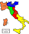 Italia1859-HE.png 1,124 × 1,330; 209 KB
-
 Italia1859.png 387 × 387; 7 KB
-
 إيطاليا - فخر الدين.PNG 507 × 600; 73 KB
-
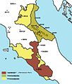
 Northern and central Italy in 1860.jpg 611 × 705; 222 KB
-
 Papal States Map 1870 ESP.jpg 258 × 345; 124 KB
-
 Papal States Map 1870.png 258 × 345; 66 KB
-
-
-
 Ferropapa.jpg 1,343 × 959; 934 KB
-
 Holy Roman Empire and Papal States 1250 (French).png 662 × 666; 288 KB
-
 Ita-papal.PNG 2,048 × 2,458; 275 KB
-
 Karte kirchenstaat Chinese.jpg 1,200 × 1,410; 126 KB
-
 Koenigreich Neapel Sizilien.jpg 1,482 × 1,899; 221 KB
-

-
 Map Flag of the Papal States (1833).png 3,414 × 4,500; 1.88 MB
-
 Papal States 1861.svg 450 × 456; 830 KB


-fr.png)
-fr.svg)


-en.svg)
-it.svg)
-mk.svg)
-nl.svg)


.jpg)


-es.svg)
.jpg)
Simplificado-es.svg)
-es.svg)
.svg)


.jpg)
.jpg)

.png)


.png)
