Category:Maps of the Society Islands
Jump to navigation
Jump to search
Subcategories
This category has the following 10 subcategories, out of 10 total.
Media in category "Maps of the Society Islands"
The following 21 files are in this category, out of 21 total.
-
1769 Cook Map of the Society Islands - Geographicus - SoecityIsland-cook-1769.jpg 4,000 × 2,708; 2.29 MB
-
1780 Cook - Hogg Map of Tahiti ( Society Islands ) - Geographicus - Tahiti-hogg-1780.jpg 4,000 × 2,138; 912 KB
-
PERKINS(1854) p246 MAP OF TAHITI ISLANDS.jpg 2,137 × 1,297; 1.11 MB
-
Admiralty Chart Catalogue 1967 Page 091 Index P1.jpg 8,580 × 6,834; 7.72 MB
-
Admiralty Chart No 1107 Plans in the Iles de la Societe, Published 1972.jpg 16,344 × 11,260; 29.98 MB
-
All the Islands accountofvoyages 02hawk 0316.jpg 3,882 × 1,942; 371 KB
-
Bora-Bora cropped from Admiralty Chart No 1107 Plans in the Iles de la Societe, Published 1972.jpg 7,861 × 10,136; 13.17 MB
-
Carte des Isles de la Societé 1790.jpg 2,048 × 1,152; 265 KB
-
Carte des isles de la Societé découvertes par le Lieutenant J. Cook, 1769 (19572710145).jpg 6,968 × 4,536; 4.46 MB
-
Edward T. Perkins, Georgian and Society Islands, 1854.jpg 3,414 × 2,061; 2.21 MB
-
Karta FP Societe isl.PNG 450 × 400; 6 KB
-
LocationSocietyIslands.PNG 250 × 158; 5 KB
-
Map-society-islands-hogg-1784.jpg 4,238 × 2,655; 9.57 MB
-
Meyer‘s Zeitungsatlas 091 – Mittelamerika.jpg 7,267 × 6,238; 13.82 MB
-
Societe isl Mehetia.PNG 447 × 211; 6 KB
-
Societyislands.jpg 5,838 × 2,553; 489 KB
-
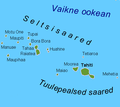
Tuulepealsed saared.png 450 × 400; 20 KB
-
Windward Islands of Society Islands.jpg 2,534 × 1,504; 485 KB


