Category:Maps of the Strait of Magellan
Jump to navigation
Jump to search
Wikimedia category | |||||
| Upload media | |||||
| Instance of | |||||
|---|---|---|---|---|---|
| Category combines topics | |||||
| Strait of Magellan | |||||
body of water in Chile connecting Atlantic and Pacific Oceans | |||||
| Instance of | |||||
| Named after | |||||
| Location | Magellan and the Chilean Antarctic Region, Chile | ||||
| Discoverer or inventor | |||||
| Inflows |
| ||||
 | |||||
Subcategories
This category has only the following subcategory.
O
Media in category "Maps of the Strait of Magellan"
The following 38 files are in this category, out of 38 total.
-
Admiralty Chart No 1281 Segunda Angostura to Paso del Mar, Published 1961.jpg 16,251 × 11,076; 31.86 MB
-
Admiralty Chart No 3107 Puerto San Julian to Estrecho de Magallanes, Published 1964.jpg 11,221 × 16,464; 14.75 MB
-
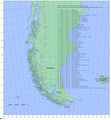
Baselines chile.png 1,653 × 1,787; 894 KB
-
Brunswick Peninsula.JPG 668 × 371; 63 KB
-
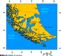
Chile Dawson Island.png 2,111 × 1,389; 597 KB
-
Chile.estrechodemagallanes.png 2,111 × 1,389; 757 KB
-
Cities of Tierra del Fuego Brunswick Peninsula.jpg 519 × 475; 156 KB
-
Cities of Tierra del Fuego.png 519 × 475; 21 KB
-
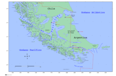
Extremo sur de América del Sur - map-ES.png 3,844 × 2,292; 1.76 MB
-
Frezier Voyage Amerique.jpg 1,770 × 1,195; 658 KB
-
Fuegio.png 504 × 477; 14 KB
-
Isla Grande de Tierra del Fuego.png 519 × 475; 28 KB
-
Kap Hoorn vs Magellanstr.jpg 2,200 × 1,650; 1.27 MB
-
Magallanes y Antártica Chilena location map (South American part) (+claims).svg 1,535 × 1,550; 830 KB
-
Magallanes y Antártica Chilena location map (South American part) (+claims, 1974).svg 1,535 × 1,550; 1.15 MB
-
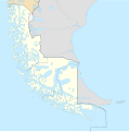
Magallanes y Antártica Chilena location map (South American part).svg 1,535 × 1,550; 831 KB
-
Map free PAIKE.JPG 800 × 490; 68 KB
-
Map of Tierra del Fuego Demis.png 1,129 × 886; 238 KB
-
Metula.svg 842 × 659; 241 KB
-
OpenSeaMap-ChartBundleArea-MagellanStrait-2016-05.png 640 × 502; 135 KB
-
Ostmund.two.de.png 499 × 264; 60 KB
-
Ostmund.two.en.png 497 × 265; 66 KB
-
Ostmund.two.es.png 460 × 353; 52 KB
-
Pueblos indígenas de la Patagonia Austral.svg 1,535 × 1,550; 881 KB
-
Riesco I.JPG 943 × 534; 82 KB
-
Ruta a traves del estrecho de magallanes.svg 277 × 107; 8 KB
-
South America southern tip pol.png 3,859 × 2,383; 596 KB
-
South America southern tip pol2.svg 1,197 × 1,031; 385 KB
-
SRTM-W74.50E68.33S54.00N53.00.PuntaArenas.png 4,183 × 1,223; 4.92 MB
-
SRTM-W75.10E68.33S53.00N52.00.PuntaDelgada.png 4,749 × 1,242; 5.7 MB
-
Strait of Magellan's discovery 1520 mk.svg 3,275 × 2,635; 844 KB
-
Strait of Magellan's discovery 1520.svg 3,275 × 2,635; 678 KB
-
Sur2-KDS444.gif 3,414 × 2,359; 1.95 MB
-
Sur2.gif 3,855 × 2,379; 707 KB
-
Tierra del Fuego location map.svg 1,535 × 1,550; 824 KB
-
Tierra del Fuego location of Ushuaia.jpg 297 × 303; 81 KB

