Category:Maps of the Warring States Period
Jump to navigation
Jump to search
Media in category "Maps of the Warring States Period"
The following 67 files are in this category, out of 67 total.
-
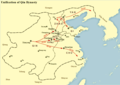
 Battle of Changping.png 831 × 545; 614 KB
-
 Battle of Guiling.png 816 × 551; 410 KB
-
 Battle of Handan.png 806 × 559; 590 KB
-
 Chienquocthathung260TCN.jpg 4,724 × 4,348; 1.89 MB
-
 China 2b2-zh-classical.png 436 × 556; 280 KB
-
 China Warring States Period.jpg 424 × 528; 71 KB
-
 China Warring States Period.png 432 × 552; 358 KB
-
 De stridande staterna animering.gif 675 × 719; 235 KB
-
 Dujiangyan.png 846 × 732; 322 KB
-
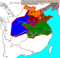
 Early Warring States Period.png 1,272 × 900; 376 KB
-
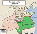 EN-CHU260BCE.jpg 4,724 × 4,348; 1.81 MB
-
 EN-HAN260BCE.jpg 4,724 × 4,348; 1.75 MB
-
 EN-QI260BCE.jpg 4,724 × 4,348; 1.75 MB
-
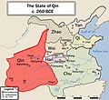 EN-QIN260BCE.jpg 4,724 × 4,348; 1.82 MB
-
 EN-WarringStatesAll260BCE.jpg 4,724 × 4,348; 1.77 MB
-
 EN-WEI260BCE.jpg 4,724 × 4,348; 1.75 MB
-
 EN-YAN260BCE.jpg 4,724 × 4,348; 1.51 MB
-
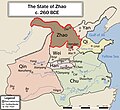 EN-ZHAO260BCE.jpg 4,724 × 4,348; 1.75 MB
-
 Handan Zhanguo.svg 492 × 526; 27 KB
-
 Linzi Zhanguo.svg 492 × 548; 47 KB
-
 Qin Unification.png 1,272 × 900; 405 KB
-
 Reiaumes Combatents vèrs 260 avC.png 513 × 472; 47 KB
-
 Royaumes combattants 250 aC-es.svg 568 × 384; 716 KB
-
 Royaumes combattants 250 aC.svg 568 × 384; 716 KB
-
 Royaumes combattants 350 aC-es.svg 572 × 383; 730 KB
-
 Royaumes combattants 350 aC.svg 568 × 384; 732 KB
-
 Sketch Map of China during the Chou Dynasty.jpg 2,897 × 1,969; 904 KB
-
 State of Chu 300 BCE.png 554 × 535; 178 KB
-
 State of Han 300 BCE.png 556 × 537; 180 KB
-
 State of Qi 300 BCE.png 556 × 537; 180 KB
-
 State of Qin 300 BCE.png 556 × 537; 179 KB
-
 State of Wei 300 BCE.png 556 × 537; 180 KB
-
 State of Yan 300 BCE.png 556 × 537; 181 KB
-
 State of Zhao 300 BCE.png 555 × 537; 180 KB
-
 Streitende-Reiche2.jpg 886 × 896; 639 KB
-
 Strijdende Staten 2.gif 517 × 498; 25 KB
-
 Warring States 350 BC.png 364 × 421; 39 KB
-
 WarringStatesAll260BCE-ar.png 4,724 × 4,348; 4.56 MB
-
 WarringStatesChinaKoreanmap.png 1,000 × 920; 415 KB
-
 ZH-战国七雄地图.jpg 4,724 × 4,348; 1.68 MB
-
 ZH-楚国地图260BCE.jpg 4,724 × 4,348; 1.64 MB
-
 ZH-燕国地图260BCE.jpg 4,724 × 4,348; 1.67 MB
-
 ZH-秦国地图260BCE.jpg 4,724 × 4,348; 1.52 MB
-
 ZH-秦國地圖260BCE.jpg 4,724 × 4,348; 1.57 MB
-
 ZH-赵国地图260BCE.jpg 4,724 × 4,348; 1.66 MB
-
 ZH-韩国地图260BCE.jpg 4,724 × 4,348; 1.67 MB
-
 ZH-魏国地图260BCE.jpg 4,724 × 4,348; 1.67 MB
-
 ZH-齐国地图260BCE.jpg 4,724 × 4,348; 1.67 MB
-
 Zhanguo-chu.png 4,710 × 4,129; 200 KB
-
 Zhanguo-han.png 4,720 × 4,119; 198 KB
-
 Zhanguo-qi.png 4,720 × 4,119; 199 KB
-
 Zhanguo-qin.png 4,715 × 4,124; 201 KB
-
 Zhanguo-wei.png 4,720 × 4,134; 199 KB
-
 Zhanguo-yan.png 4,724 × 4,134; 199 KB
-
 Zhanguo-zhao.png 4,720 × 4,159; 199 KB
-
 Zhao.png 2,000 × 1,065; 4.37 MB
-
 Китай в эпоху Сражающихся царств.jpg 1,576 × 1,220; 196 KB
-
 中国戦国時代.PNG 730 × 686; 41 KB
-
 战国形势图(前280年)(简).png 736 × 786; 666 KB
-
 战国形势图(前350年)(简).png 736 × 786; 689 KB
-
 战国形势图(前350年)(繁).png 736 × 786; 668 KB
-
 战国(前280年)(繁).png 736 × 786; 668 KB
-
 戰國七雄地圖(國名空白)-zhtw.png 4,000 × 3,682; 3.96 MB
-
 戰國七雄地圖-ZH-FR.png 4,000 × 3,682; 3.72 MB
-
 戰國七雄地圖-zhtw.png 4,000 × 3,682; 4.12 MB
-
 春秋诸侯大国简图 vi.png 620 × 570; 543 KB
-
 전국시대BC350년.png 583 × 381; 28 KB


-zhtw.png)


