Category:Maps of the border between the Republic of Ireland and the United Kingdom
Jump to navigation
Jump to search
Media in category "Maps of the border between the Republic of Ireland and the United Kingdom"
The following 14 files are in this category, out of 14 total.
-
 Donegal-Derry.jpg 2,016 × 1,512; 1.02 MB
-
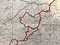
 Eastern Fermanagh.jpg 2,016 × 1,512; 908 KB
-
 Inner Irish Border.svg 2,200 × 2,800; 204 KB
-
 Ireland.svg 2,200 × 2,800; 204 KB
-
 Irish Boundary Commission final report map (1925) - religious distribution.png 1,078 × 1,182; 2.31 MB
-
 Irish Boundary Commission final report map (1925).jpg 2,016 × 1,512; 1,016 KB
-
 Large map - Religions.jpg 3,004 × 3,225; 1.67 MB
-
 Northern Ireland relief de.svg 1,210 × 908; 2.82 MB
-
 Northern Ireland.png 1,613 × 1,210; 2.44 MB
-
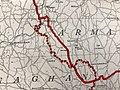
 South Armagh.jpg 1,925 × 1,444; 912 KB
-
 Southern Fermanagh.jpg 2,016 × 1,512; 1.15 MB
-
 SW Fermanagh.jpg 1,512 × 2,016; 981 KB
-
 West Armagh.jpg 2,016 × 1,512; 992 KB
-
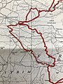
 West Tyrone.jpg 1,961 × 1,471; 996 KB


_-_religious_distribution.png)
.jpg)


