Category:Maps of the canton of Aargau to 2009
Jump to navigation
Jump to search
Media in category "Maps of the canton of Aargau to 2009"
The following 19 files are in this category, out of 19 total.
-
Karte Kanton Aargau Bezirke 2009.png 2,066 × 1,803; 947 KB
-
Karte Kanton Aargau.png 1,062 × 926; 212 KB
-
Karte Kanton Aargau Bezirke.png 1,062 × 926; 244 KB
-
Bailliage de Schenkenberg.png 383 × 354; 76 KB
-
Karte Bezirk Aarau.png 944 × 882; 258 KB
-
Karte Bezirk Baden.png 944 × 882; 261 KB
-
Karte Bezirk Bremgarten.png 944 × 882; 258 KB
-
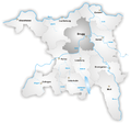
Karte Bezirk Brugg.png 944 × 882; 259 KB
-
Karte Bezirk Kulm.png 944 × 882; 257 KB
-
Karte Bezirk Laufenburg.png 944 × 882; 260 KB
-
Karte Bezirk Lenzburg.png 944 × 882; 258 KB
-
Karte Bezirk Muri.png 944 × 882; 259 KB
-
Karte Bezirk Rheinfelden.png 944 × 882; 257 KB
-
Karte Bezirk Zofingen.png 944 × 882; 258 KB
-
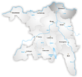
Karte Bezirk Zurzach.png 944 × 882; 258 KB
-
Karte Gemeinden des Kantons Aargau 2006.png 2,952 × 2,820; 1.72 MB
-
Karte Gemeinden des Kantons Aargau farbig 2008.png 2,952 × 2,820; 2.27 MB
-
Map Canton Aargau Districts.png 640 × 597; 127 KB
-
Ag bezirk bremgarten.png 210 × 200; 3 KB


