Category:Maps of the districts of the municipality Südharz
Jump to navigation
Jump to search
Media in category "Maps of the districts of the municipality Südharz"
The following 16 files are in this category, out of 16 total.
-
 Bennungen in Südharz.svg 475 × 449; 193 KB
-
 Breitenstein in Südharz.svg 475 × 449; 193 KB
-
 Breitungen in Südharz.svg 475 × 449; 193 KB
-
 Dietersdorf in Südharz.svg 475 × 449; 193 KB
-
 Districts of Südharz.svg 475 × 449; 194 KB
-
 Drebsdorf in Südharz.svg 475 × 449; 193 KB
-
 Hainrode in Südharz.svg 475 × 449; 193 KB
-
 Hayn in Südharz.svg 475 × 449; 193 KB
-
 Kleinleinungen in Südharz.svg 475 × 449; 193 KB
-
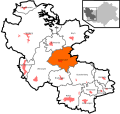
 Questenberg in Südharz.svg 475 × 449; 193 KB
-
 Rottleberode in Südharz.svg 475 × 449; 193 KB
-
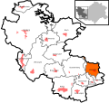
 Roßla in Südharz.svg 475 × 449; 193 KB
-
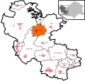 Schwenda in Südharz.svg 475 × 449; 195 KB
-
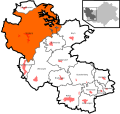 Stolberg in Südharz.svg 475 × 449; 193 KB
-
 Uftrungen in Südharz.svg 475 × 449; 193 KB
-
 Wickerode in Südharz.svg 475 × 449; 193 KB


