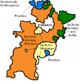
Category:Maps of the history of Thuringia
Jump to navigation
Jump to search
Federal states of Germany:
Use the appropriate category for maps showing all or a large part of Thuringia. See subcategories for smaller areas:
| If the map shows | Category to use |
|---|---|
| Thuringia on a recently created map | Category:Maps of Thuringia or its subcategories |
| Thuringia on a map created more than 70 years ago | Category:Old maps of Thuringia or its subcategories |
| the history of Thuringia on a recently created map | Category:Maps of the history of Thuringia or its subcategories |
| the history of Thuringia on a map created more than 70 years ago | Category:Old maps of the history of Thuringia or its subcategories |
Subcategories
This category has the following 20 subcategories, out of 20 total.
A
D
E
- Maps of Bezirk Erfurt (21 F)
G
- Maps of Gera District (GDR) (21 F)
H
M
- Maps of Grabfeld (5 F)
- Maps of Saxe-Altenburg (12 F)
- Maps of Saxe-Coburg and Gotha (19 F)
- Maps of Saxe-Meiningen (11 F)
- Maps of Saxe-Weimar-Eisenach (14 F)
- Maps of Schwarzburg-Rudolstadt (13 F)
- Maps of Thuringia (1920–1952) (24 F)
S
- Maps of Suhl District (GDR) (14 F)
T
^
Media in category "Maps of the history of Thuringia"
The following 134 files are in this category, out of 134 total.
-
 C. 768 Frankish Dominions (486-768).jpg 3,890 × 3,010; 3.66 MB
-
 C. 800 Carolingian Empire.jpg 2,204 × 1,880; 2.98 MB
-
 C. 814 Frankish Kingdoms.jpg 1,267 × 792; 721 KB
-
 C. 843 Division of Carolingian Empire.jpg 2,201 × 1,874; 3.08 MB
-
 C. 888 Europe.jpg 2,305 × 1,454; 1.73 MB
-
 C. 900 Frankish Dominions (768-900).jpg 3,879 × 3,031; 3.8 MB
-
 C. 962 Europe.jpg 4,066 × 3,010; 3.6 MB
-
 C. 1000 Europe and Byzantine Empire.jpg 1,349 × 1,055; 1.83 MB
-
 C. 1000 Western Europe.jpg 1,454 × 1,302; 2.1 MB
-
 C. 1360 Europe and Western Asia.jpg 2,112 × 1,365; 2.11 MB
-
 C. 1360 Europe.jpg 4,045 × 3,000; 3.9 MB
-
 147 of 'Thüringen. Ein geographisches Handbuch, etc' (11215092953).jpg 2,032 × 1,696; 568 KB
-

-

-
 Battle of Jena-Auerstedt - Map01.jpg 1,295 × 990; 936 KB
-
 1807 Dept-Harz.JPG 499 × 515; 64 KB
-
 182 of 'Thüringen. Ein geographisches Handbuch, etc' (11216386236).jpg 1,672 × 1,765; 1.05 MB
-
-

-
 THUERINGEN.png 2,358 × 1,857; 219 KB
-
 THUERINGEN1920.png 1,486 × 1,030; 42 KB
-
 WAK Staaten.PNG 500 × 524; 25 KB
-
 200 of 'Thüringen. Ein geographisches Handbuch, etc' (11219106075).jpg 1,687 × 1,817; 831 KB
-
 Landratsämter Altenburg und Ronneburg.svg 2,092 × 1,612; 1.32 MB
-
 BildungThueringen1990.svg 2,369 × 1,951; 78 KB
-

-
 CoburgGothaDet.jpg 404 × 821; 70 KB
-
 CountyLocatorThuringia1922-ABG.svg 813 × 595; 36 KB
-
 CountyLocatorThuringia1922-ARN.svg 813 × 595; 36 KB
-
 CountyLocatorThuringia1922-Camburg.svg 813 × 595; 36 KB
-
 CountyLocatorThuringia1922-ESA.svg 813 × 595; 36 KB
-
 CountyLocatorThuringia1922-G.svg 813 × 595; 36 KB
-
 CountyLocatorThuringia1922-GRZ.svg 813 × 595; 36 KB
-
 CountyLocatorThuringia1922-GTH.svg 813 × 595; 36 KB
-
 CountyLocatorThuringia1922-HBN.svg 813 × 595; 36 KB
-
 CountyLocatorThuringia1922-MGN.svg 813 × 595; 36 KB
-
 CountyLocatorThuringia1922-RU.svg 813 × 595; 36 KB
-
 CountyLocatorThuringia1922-SCZ.svg 813 × 595; 36 KB
-
 CountyLocatorThuringia1922-SDH.svg 813 × 595; 36 KB
-
 CountyLocatorThuringia1922-SLF.svg 813 × 595; 36 KB
-
 CountyLocatorThuringia1922-SON.svg 813 × 595; 36 KB
-
 CountyLocatorThuringia1922-SRO.svg 813 × 595; 36 KB
-
 CountyLocatorThuringia1922-WE.svg 813 × 595; 36 KB
-

-
 DDR-Bezirk-Erfurt-Kreis-Arnstadt.png 1,500 × 2,036; 152 KB
-
 DDR-Bezirk-Suhl.png 1,500 × 2,036; 42 KB
-
 EisenachDet.jpg 285 × 487; 31 KB
-
 Erfurter Teilung 1572.jpg 1,199 × 768; 412 KB
-
 Ernestijnse.png 1,070 × 795; 81 KB
-
 Ernestine Saxony 1517.svg 4,274 × 3,200; 645 KB
-
 Frankenreich unter den Merowingern (Thüringen).jpg 710 × 1,031; 466 KB
-
 GDR Bezirk Erfurt location map.svg 208 × 167; 28 KB
-
 GDR Bezirk Gera location map.svg 157 × 117; 87 KB
-
 GDR Bezirk Suhl location map.svg 179 × 127; 23 KB
-
 DDR-Bezirk-Gera.png 1,500 × 2,036; 53 KB
-
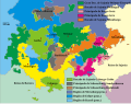
 GliederungThueringen1922-es.svg 3,951 × 2,800; 224 KB
-
 GliederungThueringen1922.svg 3,951 × 2,800; 82 KB
-
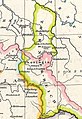
 Grafschaft Henneberg um 1350.svg 516 × 551; 84 KB
-
 GTH Karte alt.PNG 700 × 922; 22 KB
-
 Helmegau.jpg 4,000 × 2,851; 5.34 MB
-
 Henneberg-Franken heute.png 691 × 664; 114 KB
-
 HRR 1400, Ausschnitt Grafschaft Hohnstein.jpg 398 × 399; 68 KB
-

-
 IK Staaten.PNG 1,298 × 1,606; 149 KB
-

-
 Karte Wanfrieder Abkommen.png 1,858 × 1,263; 332 KB
-
 Karte-HSG.png 521 × 715; 118 KB
-
 KreisreformThueringen1994-es.svg 2,369 × 1,951; 94 KB
-
 KreisreformThueringen1994.svg 2,369 × 1,951; 93 KB
-

-

-
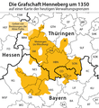 Lagekarte Grafschaft Henneberg um 1350.png 706 × 767; 123 KB
-
 Landkreis Herrschaft Schmalkalden.png 827 × 667; 32 KB
-
 Leuchtenburg Karte Amt Leuchtenburg.jpg 3,890 × 2,717; 1.62 MB
-
 Locator Counties ruled by Reuss Elder Line (1680).svg 1,329 × 1,164; 394 KB
-
 Locator Counties ruled by Reuss Younger Line (1680).svg 1,329 × 1,164; 394 KB
-
 Locator County of Schwarzburg-Rudolstadt (1680).svg 1,329 × 1,164; 394 KB
-
 Locator County of Schwarzburg-Sondershausen (1680).svg 1,329 × 1,164; 394 KB
-
 Locator Duchy of Saxe-Coburg (1680).svg 1,329 × 1,164; 394 KB
-
 Locator Duchy of Saxe-Eisenach (1680).svg 1,329 × 1,164; 393 KB
-
 Locator Duchy of Saxe-Eisenberg (1680).svg 1,329 × 1,164; 394 KB
-
 Locator Duchy of Saxe-Gotha-Altenburg (1680).svg 1,329 × 1,164; 394 KB
-
 Locator Duchy of Saxe-Hildburghausen (1680).svg 1,329 × 1,164; 394 KB
-
 Locator Duchy of Saxe-Jena (1680).svg 1,329 × 1,164; 394 KB
-
 Locator Duchy of Saxe-Meiningen (1680).svg 1,329 × 1,164; 394 KB
-
 Locator Duchy of Saxe-Römhild (1680).svg 1,329 × 1,164; 394 KB
-
 Locator Duchy of Saxe-Saalfeld (1680).svg 1,329 × 1,164; 394 KB
-
 Locator Duchy of Saxe-Weimar (1680).svg 1,329 × 1,164; 394 KB
-
 Locator Duchy of Saxe-Zeitz (1680).svg 1,329 × 1,164; 394 KB
-
 Locator Duchy of Saxony (1554-1566)-NL.svg 1,725 × 1,160; 444 KB
-
 Locator Erfurter Staat (1680).svg 1,329 × 1,164; 394 KB
-
 Luther region 1519.png 1,119 × 712; 2.3 MB
-
 Map of Thuringia (1680)-DE.svg 1,329 × 1,164; 1.18 MB
-
 Map of Thuringia (1680)-NL.svg 1,329 × 1,164; 1.43 MB
-
 Map-DB-Sachsen-Weimar-Eisenach.svg 1,793 × 1,571; 1.67 MB
-
 Map-WR-Thuringia.svg 1,185 × 1,007; 541 KB
-
 Landkreis Saalfeld.png 2,004 × 1,552; 118 KB
-
 Osterland 1250.PNG 303 × 263; 75 KB
-
 S-Gotha-Altenburg.png 713 × 369; 16 KB
-
 Sachsen-Anhalt Landesteile Beschriftet.png 1,096 × 1,128; 30 KB
-
 Sachsen-Anhalt Landesteile.png 1,096 × 1,128; 13 KB
-
 Sachsen-Coburg und Gotha.png 2,104 × 1,630; 88 KB
-
 SajoniaCoburgGotha.jpg 550 × 450; 50 KB
-
 SajoniaEisenach.jpg 550 × 450; 51 KB
-
 SajoniaGothaAltenburg.jpg 550 × 450; 51 KB
-
 Saxony (Division of Leipzig) - DE.png 1,430 × 959; 653 KB
-
 Saxony (Division of Leipzig) - NL.png 2,875 × 1,933; 1.44 MB
-
 Saxony after the Capitulation of Wittenberg (1547) - DE.png 1,428 × 958; 717 KB
-
 Saxony after the Capitulation of Wittenberg (1547) - NL.png 2,875 × 1,933; 1.63 MB
-
 Saxony after the Treaty of Naumburg - DE.png 2,892 × 1,953; 955 KB
-
 Saxony after the Treaty of Naumburg - NL.png 1,928 × 1,302; 862 KB
-
 Schuchardt Atlas Nds (6).jpg 3,048 × 1,543; 2.06 MB
-
 Schulkarte des Koenigreichs Sachsen.jpg 8,058 × 5,977; 13.45 MB
-
 SchwarzburgSondershausen.png 2,004 × 1,552; 105 KB
-
 Spruner-Menke Handatlas 1880 Karte 33.jpg 10,433 × 8,577; 18.37 MB
-
 Spruner-Menke Handatlas 1880 Karte 34 (Thuringia).jpg 4,485 × 3,158; 6.65 MB
-
 Spruner-Menke Handatlas 1880 Karte 34.jpg 10,508 × 8,658; 22.59 MB
-
 Spruner-Menke Handatlas 1880 Karte 39 (Thuringia 1200).jpg 2,897 × 2,129; 2.75 MB
-
 Spruner-Menke Handatlas 1880 Karte 44 Nebenkarte 2.jpg 2,657 × 2,266; 654 KB
-
 Spruner-Menke Handatlas 1880 Karte 45 (Erfurt 1648-1742).jpg 752 × 717; 341 KB
-
 Spruner-Menke Handatlas 1880 Karte 45 Nebenkarte 7.jpg 2,694 × 2,250; 721 KB
-
 Thueringen 1910-es.svg 1,177 × 925; 311 KB
-
 Thueringen 1910.svg 1,177 × 925; 68 KB
-
 ThueringenKeizerrijk.png 1,200 × 1,015; 37 KB
-
 Thuringia 1910 - en.svg 1,177 × 925; 75 KB
-
 Thuringia 1910 - es.svg 1,177 × 925; 406 KB
-
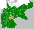
 Thuringia in the German Reich (1925).svg 1,425 × 1,133; 967 KB
-
 Thüringen 1920.svg 1,400 × 1,000; 46 KB
-
 Thüringen in German Democratic Republic 1949 - 1952.svg 618 × 789; 574 KB
-
 Topographisch-militairische Charte von Teutschland - Section 068.png 3,466 × 2,711; 20.64 MB
-
 Topographisch-militairische Charte von Teutschland - Section 081.png 3,425 × 2,698; 20.66 MB
-
 Topographisch-militairische Charte von Teutschland - Section 082.png 3,425 × 2,707; 20.94 MB
-
 Topographisch-militairische Charte von Teutschland - Section 083.png 3,412 × 2,695; 23.15 MB
-
 Vogtland 1350.png 800 × 966; 174 KB
.jpg)


.jpg)


.jpg)
_in_suas_Praefecturas_accurate_divisi_descriptio_qui_accedit_Erfordiae_Urbis_exterior_Facies_et_Prospectus_-_Auctore_Joh._Bapt._Homanno_;_Revidit_Fredericus_Zollmannus,_A._1717_-_btv1b5971580n.jpg)


.jpg)


.jpg)


_-_btv1b8494089j.jpg)


.jpg)


_-_Grav%C3%A9..._-_btv1b84933364.jpg)


.svg)
.svg)
.svg)
.svg)
.svg)
.svg)
.svg)
.svg)
.svg)
.svg)
.svg)
.svg)
.svg)
.svg)
.svg)
-NL.svg)
.svg)

-DE.svg)
-NL.svg)


_-_DE.png)
_-_NL.png)
_-_DE.png)
_-_NL.png)


.jpg)


.jpg)

.jpg)

.jpg)


.svg)


