Category:Maps of the history of the United Kingdom
Jump to navigation
Jump to search
Countries of Europe: Albania · Andorra · Armenia‡ · Austria · Azerbaijan‡ · Belarus · Belgium · Bosnia and Herzegovina · Bulgaria · Croatia · Cyprus‡ · Czech Republic · Denmark · Estonia · Finland · France‡ · Georgia‡ · Germany · Greece · Hungary · Iceland · Republic of Ireland · Italy · Kazakhstan‡ · Latvia · Lithuania · Luxembourg · Malta · Moldova · Montenegro · Netherlands‡ · North Macedonia · Norway · Poland · Portugal‡ · Romania · Russia‡ · Serbia · Slovakia · Slovenia · Spain‡ · Sweden · Switzerland · Turkey‡ · Ukraine · United Kingdom
Limited recognition: Abkhazia‡ · Kosovo · South Ossetia‡ · Transnistria · Northern Cyprus‡
‡: partly located in Europe
Limited recognition: Abkhazia‡ · Kosovo · South Ossetia‡ · Transnistria · Northern Cyprus‡
‡: partly located in Europe
Wikimedia category | |||||
| Upload media | |||||
| Instance of | |||||
|---|---|---|---|---|---|
| |||||
Subcategories
This category has the following 14 subcategories, out of 14 total.
Media in category "Maps of the history of the United Kingdom"
The following 67 files are in this category, out of 67 total.
-
ArmaghBrit4.png 468 × 487; 12 KB
-
Britain peoples circa 600 de.svg 578 × 772; 1.78 MB
-
Britain peoples circa 600 fa.svg 994 × 1,233; 1.33 MB
-
Britain peoples circa 600 ru.svg 994 × 1,233; 1.32 MB
-
Britain peoples circa 600-es.svg 994 × 1,233; 3.44 MB
-
Britain peoples circa 600-hu.svg 994 × 1,233; 1.65 MB
-
Britain peoples circa 600-ko.svg 994 × 1,233; 1.33 MB
-
Britain peoples circa 600-pt.svg 994 × 1,233; 1.33 MB
-
Britain peoples circa 600.svg 994 × 1,233; 1.88 MB
-
British 7th Century.png 1,000 × 1,320; 1.59 MB
-
British former postal counties (numbered).svg 690 × 1,035; 1.02 MB
-
British kingdoms c 800 he.PNG 669 × 1,184; 435 KB
-
British kingdoms c 800.gif 708 × 1,164; 282 KB
-
British kingdoms c 800.png 1,000 × 1,320; 1.59 MB
-
British seventh century kingdoms.png 526 × 880; 211 KB
-
CountiesOfGreatBritain.PNG 797 × 1,264; 239 KB
-
Craven District-Yorkshire-map-relief 2.jpg 1,039 × 791; 263 KB
-
Curactes-in-Craven-Yorkshire-in-1086.png 965 × 571; 446 KB
-
Doomsday Book - Counties of England - 1086.png 502 × 462; 202 KB
-
DownBrit4.png 468 × 487; 12 KB
-
England1683.svg 846 × 1,208; 279 KB
-
Eric places.jpg 599 × 792; 89 KB
-
FermanaghBrit4.GIF 468 × 487; 12 KB
-
GreatBritain802.png 323 × 480; 31 KB
-
HeptarquiaBernicia.jpg 412 × 533; 31 KB
-
HeptarquiaDeira.jpg 412 × 533; 32 KB
-
History of England (1879) (14779456954).jpg 1,232 × 2,066; 483 KB
-
History of Visa policy of the UK.gif 1,056 × 463; 1.48 MB
-
Illas Britanicas - Conquista normanda d'Anglatèrra.png 801 × 956; 282 KB
-
Illas Britanicas - Guèrra Civila Anglesa (1642-1651).png 801 × 956; 329 KB
-
Inglaterra anglosajona new.png 651 × 896; 401 KB
-
Isle of Ely and Camp of Refuge map.jpg 300 × 450; 31 KB
-
Jacobite Uprising 1689-91.png 388 × 474; 69 KB
-
Kingdom of Great Britain.png 1,218 × 1,245; 39 KB
-
L'Ecosse divisée en Shires ou Comtés.jpg 8,881 × 6,458; 15.8 MB
-
LondonderryBrit4.GIF 468 × 487; 11 KB
-
Map Gaels Brythons Picts patterns.png 778 × 829; 75 KB
-
Map Gaels Brythons Picts.png 643 × 829; 66 KB
-
Map of Britain in 626 A.D. Wellcome M0008071.jpg 2,616 × 4,061; 2.76 MB
-
MappaBritanniaeFacie.jpg 2,954 × 2,557; 837 KB
-
MappaBritanniaeFacie2.png 1,500 × 1,312; 4.43 MB
-
MappaBritanniaeFacie3.png 1,100 × 936; 2.13 MB
-
MappaBritanniaeFacie4.png 1,400 × 1,690; 4.25 MB
-
Maritime Fur Trade-WorldContext.png 1,378 × 805; 232 KB
-
Old norse, ca 900.PNG 1,235 × 909; 100 KB
-
Partie de l'Angleterre.jpg 9,062 × 6,685; 14.41 MB
-
Political map of England 1140.PNG 1,489 × 1,213; 163 KB
-
Political map of England 1140.svg 1,396 × 1,137; 191 KB
-
Political map of England 1153.PNG 1,489 × 1,753; 217 KB
-
Political map of England 1153.svg 1,396 × 1,644; 106 KB
-
Porthcurno cables.jpg 300 × 303; 48 KB
-
Routes of the Spanish Armada cs.svg 411 × 753; 168 KB
-
Routes of the Spanish Armada-es.svg 411 × 753; 172 KB
-
Routes of the Spanish Armada-zh-classical.png 415 × 756; 22 KB
-
Routes of the Spanish Armada.gif 415 × 756; 27 KB
-
ShepardMap802Northumbria.png 650 × 834; 359 KB
-
Sykes picot-he.jpg 452 × 433; 45 KB
-
Sykes picot.jpg 452 × 433; 51 KB
-
The British Isles about 1300.jpg 1,147 × 1,808; 362 KB
-
The British Isles around 1300.png 1,731 × 2,456; 2.09 MB
-
Titanicmap.png 431 × 179; 3 KB
-
TyroneBrit4.GIF 468 × 487; 12 KB
-
Whittlesey Mere map 1786.jpg 3,946 × 2,454; 3.42 MB
-
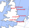
WWI German targets in England (zoomed).png 279 × 270; 24 KB
-
WWI German targets in England.png 409 × 372; 38 KB


