Category:Maps of the medieval Low Countries
Jump to navigation
Jump to search
For the purpose of this category, 'medieval Low Countries' will be considered the territories of the Low Countries (including those currently belonging to Belgium, the Netherlands, and Luxemburg (=Benelux), and the parts of northern France and western Germany that are historically grouped amongst the Low Countries) between the years 500 and 1500.
Subcategories
This category has only the following subcategory.
M
Media in category "Maps of the medieval Low Countries"
The following 67 files are in this category, out of 67 total.
-
 Brabant primitif.jpg 744 × 442; 64 KB
-
 Low Countries Locator Flanders.svg 1,550 × 2,000; 381 KB
-
 Low Countries Locator Luxembourg.svg 1,550 × 2,000; 381 KB
-
 Low Countries Locator Prince-Bischopric of Liege.svg 1,550 × 2,000; 381 KB
-
 Image-Map Bavaria-Straubing - Karte Straubing-Holland empty.png 1,000 × 984; 140 KB
-
 Map Bavaria-Straubing - Karte Straubing-Holland.png 1,000 × 984; 256 KB
-
 Burgundian State 1364-1404.svg 5,805 × 7,573; 1,004 KB
-
 Carte Etat bourguignon (Philippe le Hardi).svg 1,195 × 1,786; 434 KB
-
 Carte Etat bourguignons 1-es.svg 1,195 × 1,786; 1.54 MB
-
 Etat bourguignons.png 1,210 × 1,851; 618 KB
-
 Karte Haus Burgund 1.png 2,500 × 3,724; 859 KB
-
 Karte Haus Burgund 2-es.svg 5,442 × 7,100; 1.85 MB
-
 Karte Haus Burgund 2.png 1,200 × 1,787; 250 KB
-
 Karte-Haus-Burgund-FR.png 2,500 × 3,724; 831 KB
-
 Reiseroute von Johanna von Bayern 1370.png 1,000 × 983; 263 KB
-
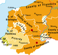
 County of Flanders (topogaphy).png 760 × 645; 190 KB
-
 Prince-Bishopric of Liége (topogaphy)-nl.png 632 × 900; 198 KB
-
 Etat bourguignon Philippe le Bon Fr.png 1,213 × 1,802; 837 KB
-
 Etat bourguignon Philippe le Bon-es.svg 5,442 × 7,100; 2.15 MB
-
 Karte Haus Burgund 3-es.svg 5,442 × 7,100; 1.74 MB
-
 Karte Haus Burgund 3.png 1,200 × 1,787; 281 KB
-
 Burgundian northern France 1465–1477.png 416 × 399; 92 KB
-
 Karte Haus Burgund 4 EN.png 2,500 × 3,521; 1.33 MB
-
 Karte Haus Burgund 4.png 2,500 × 3,521; 1.36 MB
-
 Karte Haus Burgund Verwaltu.png 1,200 × 1,787; 227 KB
-
 Karte Haus Burgund 5.png 1,200 × 1,787; 449 KB
-
 Karte-Haus-Burgund 5-es.svg 5,442 × 7,100; 2.12 MB
-
 Luxemburg1477.png 295 × 351; 191 KB
-
 Bisbats dels Països Baixos abans de la reforma del 1559.png 1,664 × 2,284; 14.52 MB
-
 Brabant1477.png 409 × 362; 331 KB
-
 Brabanter Straße (Waldseemueller).jpg 755 × 273; 101 KB
-
 Old cambrai diocese.png 1,664 × 2,284; 95 KB
-
 Super Universas Dioceses NL.png 1,664 × 2,284; 344 KB
-
 Diocese Liege and Prince-Bishopric of Liège.svg 1,550 × 2,000; 443 KB
-
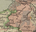
 Duchy of Burgundy (918-1477).gif 617 × 907; 68 KB
-
 Duchy of Burgundy (918-1477, Red-Version).gif 617 × 907; 96 KB
-
 Dutch Economic Center Antwerp.png 346 × 262; 54 KB
-
 Dutch Urban Centers Flanders.png 373 × 292; 51 KB
-
 Friezen en Franken.jpg 845 × 573; 102 KB
-
 Greveningen nieuw.jpg 989 × 918; 123 KB
-
 Kaart Lage Landen (Frankische tijd).jpg 1,000 × 812; 399 KB
-
 Kaart polder Spickenesse en omgeving ±1300.jpg 7,405 × 5,832; 9.17 MB
-
 Karte Haus Burgund 4 ZH.png 1,200 × 1,690; 840 KB
-
 Karte-Haus-Burgund 4-es.svg 5,442 × 7,100; 2.36 MB
-
 Karte-Haus-Burgund 4-FR.png 2,500 × 3,521; 1.34 MB
-
 Kingdom of Lotharingia and Frisia 1000.svg 512 × 359; 553 KB
-
 Lage Landen (Frankische Tijd)-es.svg 1,000 × 812; 998 KB
-
 Lage Landen (Frankische Tijd).svg 1,000 × 812; 174 KB
-
 Limburg1477.png 230 × 231; 98 KB
-
 Low Countries Locator Flanders and Artois.svg 1,550 × 2,000; 212 KB
-
 Low Countries Locator Hainaut.svg 1,550 × 2,000; 212 KB
-
 Low Countries Locator Namur.svg 1,550 × 2,000; 211 KB
-
 Low Countries Medieval Dioceses-blank.png 1,664 × 2,284; 10.89 MB
-
 Low Countries Medieval Dioceses-NL.png 1,664 × 2,284; 323 KB
-
 Map Burgundian Netherlands 1477-af.svg 744 × 1,052; 125 KB
-
 Paises Bajos, 1350-es.svg 2,818 × 3,608; 1.94 MB
-
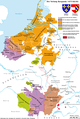
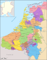
 Plain map of the low countries (1350)-NL.png 1,063 × 1,080; 272 KB
-
 Political map of Limburg (1350)-NL.svg 866 × 1,206; 888 KB
-
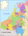
 Political map of the Low Countries (1350)-es.svg 2,818 × 3,608; 1.95 MB
-
 Political map of the Low Countries (1350)-FR.svg 2,818 × 3,608; 815 KB
-
 Political map of the Low Countries (1350)-hu.svg 2,818 × 3,608; 850 KB
-
 Political map of the Low Countries (1350)-NL.svg 2,818 × 3,608; 886 KB
-
 TA REC 015 Kaart Voorne-Putten in 1530 - L.F. Teixeira de Mattos.jpg 8,021 × 5,271; 6.4 MB
-
 Transgression marine rive Est de la Mer du Nord (de 250 à 600).jpg 600 × 389; 26 KB
-
 Urban Centers of the Dutch Low Countries.png 929 × 840; 196 KB
-
 Vlaamse gouwen.png 650 × 367; 58 KB
-
 Ниските Земји во франкиско време.svg 987 × 799; 375 KB


.svg)


.png)
-nl.png)


.gif)
.gif)


.jpg)


-es.svg)
.svg)


-NL.png)
-NL.svg)
-es.svg)
-FR.svg)
-hu.svg)
-NL.svg)


.jpg)
.jpg)