Category:Maps of unitary authorities in England
Przejdź do nawigacji
Przejdź do wyszukiwania
Podkategorie
Poniżej wyświetlono 47 spośród wszystkich 47 podkategorii tej kategorii.
B
- Maps of the Borough of Blackburn with Darwen (16 plików)
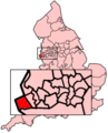
- Maps of Bournemouth (27 plików)
- Maps of the Borough of Bournemouth (10 plików)
C
- Maps of the Borough of Cheshire East (9 plików)
D
- Maps of the Borough of Darlington (5 plików)
H
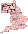
- Maps of the Borough of Halton (12 plików)
K
L
M
- Maps of the Borough of Medway (15 plików)
N
- Maps of North East Lincolnshire (10 plików)
- Maps of North Lincolnshire (24 pliki)
- Maps of North Somerset District (13 plików)
P
- Maps of the Borough of Poole (9 plików)
R
S
- Maps of the Borough of Stockton-on-Tees (6 plików)
- Maps of Stoke-on-Trent (9 plików)
T
- Maps of the Borough of Torbay (7 plików)
U
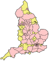
- Unitary government proposals in England, 2004 (14 plików)
W
- Maps of the Borough of Warrington (12 plików)
- Maps of Wiltshire (district) (8 plików)
Pliki w kategorii „Maps of unitary authorities in England”
Poniżej wyświetlono 27 spośród wszystkich 27 plików w tej kategorii.
-
 EnglandBirmingham.png 200 × 247; 31 KB
-
 EnglandBirmingham.svg 200 × 247; 447 KB
-
 EnglandBolton.png 200 × 247; 27 KB
-
 EnglandBury.png 200 × 247; 27 KB
-
 EnglandKirklees.png 200 × 247; 17 KB
-
 EnglandLiverpool.png 200 × 247; 26 KB
-
 EnglandManchester.png 200 × 247; 20 KB
-
 EnglandNewcastle.png 200 × 247; 16 KB
-
 EnglandRochdale.png 200 × 247; 30 KB
-
 EnglandSalford.png 200 × 247; 30 KB
-
 EnglandSandwell.png 200 × 247; 31 KB
-
 EnglandSefton.png 200 × 247; 27 KB
-
 EnglandSouthTyneside.png 200 × 247; 27 KB
-
 EnglandSunderland.png 200 × 247; 27 KB
-
 EnglandTrafford.png 200 × 247; 30 KB
-
 EnglandUnitaries.png 500 × 617; 66 KB
-
 EnglandWigan.png 200 × 247; 27 KB
-
 EnglandWirral.png 200 × 247; 27 KB
-
 EnglandWolverhampton.png 200 × 247; 31 KB
-
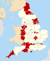
 English unitary authorities 2009.svg 1039 × 1261; 1 MB
-
 English unitary authorities 2020.svg 831 × 1009; 1,3 MB
-
 English unitary authorities 2021.svg 1108 × 1345; 371 KB
-
 English unitary authorities map 2019.svg 1108 × 1345; 392 KB
-
 English unitary authorities map 2020.svg 1108 × 1345; 392 KB
-
 English unitary authorities map 2021.svg 1108 × 1345; 394 KB
-
 English unitary authorities map 2023.svg 1108 × 1345; 397 KB
-
 Unitary-Map-EnglandSubdivisions2009.png 2165 × 2670; 184 KB


