Category:Maps of volcanoes in Oregon
Jump to navigation
Jump to search
Subcategories
This category has the following 6 subcategories, out of 6 total.
Media in category "Maps of volcanoes in Oregon"
The following 6 files are in this category, out of 6 total.
-
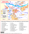
Boring lava allen map.png 690 × 800; 31 KB
-
MahoganyMountain area map.PNG 2,284 × 2,218; 407 KB
-
Newberry Volcano Map.png 480 × 638; 98 KB
-
Oregon volcanoes map.gif 906 × 666; 16 KB
-
Oregon volcanoes map.png 453 × 333; 4 KB
-
VolcanicLegacyScenicByway OregonSection.gif 361 × 600; 54 KB


