Category:Maps of wards of Bournemouth, Christchurch and Poole
Jump to navigation
Jump to search
Media in category "Maps of wards of Bournemouth, Christchurch and Poole"
The following 33 files are in this category, out of 33 total.
-

-
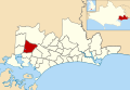
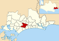
 Bournemouth, Christchurch and Poole UK ward map highlighting Bearwood and Merley.svg 1,154 × 796; 1.69 MB
-

-
 Bournemouth, Christchurch and Poole UK ward map highlighting Boscombe West.svg 1,154 × 796; 1.69 MB
-
 Bournemouth, Christchurch and Poole UK ward map highlighting Bournemouth Central.svg 1,154 × 796; 1.69 MB
-
 Bournemouth, Christchurch and Poole UK ward map highlighting Broadstone.svg 1,154 × 796; 1.69 MB
-
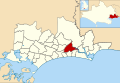
 Bournemouth, Christchurch and Poole UK ward map highlighting Burton and Grange.svg 1,154 × 796; 1.69 MB
-
 Bournemouth, Christchurch and Poole UK ward map highlighting Canford Cliffs.svg 1,154 × 796; 1.69 MB
-
 Bournemouth, Christchurch and Poole UK ward map highlighting Canford Heath.svg 1,154 × 796; 1.69 MB
-
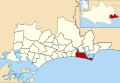
 Bournemouth, Christchurch and Poole UK ward map highlighting Christchurch Town.svg 1,154 × 796; 1.69 MB
-
 Bournemouth, Christchurch and Poole UK ward map highlighting Commons.svg 1,154 × 796; 1.69 MB
-
 Bournemouth, Christchurch and Poole UK ward map highlighting Creekmoor.svg 1,154 × 796; 1.69 MB
-

-
-
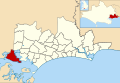 Bournemouth, Christchurch and Poole UK ward map highlighting Hamworthy.svg 1,154 × 796; 1.69 MB
-

-
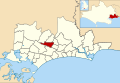
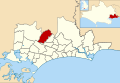 Bournemouth, Christchurch and Poole UK ward map highlighting Kinson.svg 1,154 × 796; 1.69 MB
-
-
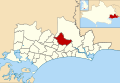
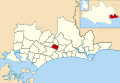
 Bournemouth, Christchurch and Poole UK ward map highlighting Moordown.svg 1,154 × 796; 1.69 MB
-
-
-

-
 Bournemouth, Christchurch and Poole UK ward map highlighting Oakdale.svg 1,154 × 796; 1.69 MB
-
 Bournemouth, Christchurch and Poole UK ward map highlighting Parkstone.svg 1,154 × 796; 1.69 MB
-
 Bournemouth, Christchurch and Poole UK ward map highlighting Penn Hill.svg 1,154 × 796; 1.69 MB
-
 Bournemouth, Christchurch and Poole UK ward map highlighting Poole Town.svg 1,154 × 796; 1.69 MB
-
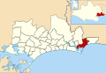
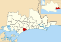
 Bournemouth, Christchurch and Poole UK ward map highlighting Queen's Park.svg 1,154 × 796; 1.69 MB
-

-
-
-
 Bournemouth, Christchurch and Poole UK ward map highlighting West Southbourne.svg 1,154 × 796; 1.69 MB
-
-
 Bournemouth, Christchurch and Poole UK ward map highlighting Winton East.svg 1,154 × 796; 1.69 MB


