Category:Maps of weather in 2011
Jump to navigation
Jump to search
Please sort by date, if specified
[[Maps of weather in 2011|MMDDhhmm]](in UTC)- take
*for complete year,MM-MMorMMDD-DDfor spans
Subcategories
This category has only the following subcategory.
P
Media in category "Maps of weather in 2011"
The following 15 files are in this category, out of 15 total.
-
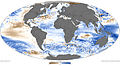
 AIRS Carbon Dioxide.png 3,672 × 1,029; 2.81 MB
-
 AIRS Methane.png 2,733 × 1,528; 3.16 MB
-
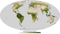 EVI.png 2,725 × 1,511; 1.66 MB
-
-
 The British Isles winter weather event deaths of 2010.png 3,320 × 3,752; 825 KB
-
 2010 New Year's Eve tornado outbreak map.png 767 × 575; 686 KB
-
 Arctic Oscillation temperature anomalies.png 4,680 × 2,340; 5.67 MB
-
 Wetter Atlantiksturm.png 1,586 × 877; 606 KB
-
 24hr Rain accumulation 2011-05-26 severe weather NE US.png 744 × 549; 348 KB
-
 Burza 2011.08.07 Lodz.JPG 799 × 585; 80 KB
-
 Irene cumulative wind history.gif 895 × 716; 34 KB
-
 2011 Bering Sea superstorm on November 8.jpg 639 × 471; 113 KB
-
 Scotland snow 6 december 2011.jpg 4,270 × 2,890; 1.35 MB
-

-
 April 4–5, 2011 tornado outbreak map.png 1,041 × 531; 992 KB


_(NOAA).jpg)


