Category:Maps showing 1000
Jump to navigation
Jump to search
| 1000 |
English: Maps showing the year 1000 (i.e. history maps)
See also category: 1000 maps. and 1000s maps for old maps created in this time.
See also category: 1000 maps. and 1000s maps for old maps created in this time.
Media in category "Maps showing 1000"
The following 7 files are in this category, out of 7 total.
-
 County of Castile 1000.png 1,278 × 896; 186 KB
-
 County of Toulouse 1000.png 2,012 × 1,396; 332 KB
-
 Eastern Europe 1000 CE.jpg 903 × 606; 118 KB
-
 España1000.jpg 442 × 379; 150 KB
-
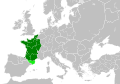 Kingdom of France 1000.svg 485 × 340; 1.22 MB
-
 Kingdom of Italy 1000.svg 485 × 340; 1.23 MB
-
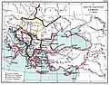 South-eastern Europe c. 1000.jpg 1,100 × 858; 221 KB


