Category:Maps showing 1037
Jump to navigation
Jump to search
| 1030 1031 1037 → |
English: Maps showing the year 1037 (i.e. history maps)
See also category: 1037 maps. and 1030s maps for old maps created in this time.
See also category: 1037 maps. and 1030s maps for old maps created in this time.
Media in category "Maps showing 1037"
The following 17 files are in this category, out of 17 total.
-
 España1037.jpg 826 × 640; 522 KB
-
 Island of the Jewel.png 2,232 × 946; 3.25 MB
-
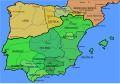
 Kingdom of Aragon-1037-ar.svg 882 × 612; 207 KB
-
 Kingdom of Aragon-1037-hu.svg 827 × 574; 257 KB
-
 Kingdom of Aragon-1037.svg 827 × 574; 255 KB
-
 Kingdom of Leon 1037 bg.svg 827 × 574; 253 KB
-
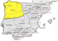 Kingdom of Leon 1037-pt.svg 827 × 574; 255 KB
-
 Kingdom of Leon 1037.svg 827 × 574; 253 KB
-
 Location map Taifa of Algeciras.svg 713 × 601; 282 KB
-
 Location map Taifa of Denia.svg 713 × 601; 279 KB
-
 Location map Taifa of Málaga.svg 713 × 601; 284 KB
-
 Map Iberian Peninsula 1037-bg.svg 827 × 574; 253 KB
-
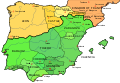 Map Iberian Peninsula 1037-en.svg 827 × 574; 252 KB
-
 Map Iberian Peninsula 1037-es.svg 827 × 574; 252 KB
-
 Map Iberian Peninsula 1037-hu.svg 827 × 574; 256 KB
-
 Map Iberian Peninsula 1037-pt.svg 512 × 355; 101 KB
-
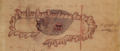
 Spain in 1037 (William R. Shepherd).jpg 860 × 673; 300 KB


.jpg)