Category:Maps showing 1714
Jump to navigation
Jump to search
| ← 1710 1711 1712 1714 1715 1716 |
English: Maps showing the year 1714 (i.e. history maps)
See also category: 1714 maps. and 1710s maps for old maps created in this time.
See also category: 1714 maps. and 1710s maps for old maps created in this time.
Media in category "Maps showing 1714"
The following 13 files are in this category, out of 13 total.
-
 Great Britain and Ireland 1714.svg 120 × 170; 220 KB
-
 417 of 'Britain and her Rivals in the eighteenth century, 1713-1789' (11232034495).jpg 2,695 × 2,322; 977 KB
-
 419 of 'Britain and her Rivals in the eighteenth century, 1713-1789' (11233442156).jpg 2,523 × 2,308; 872 KB
-
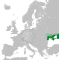 Crimean Khanate 1714.png 4,966 × 5,033; 2.42 MB
-
 Europe 1714.png 1,550 × 1,118; 1.01 MB
-
 Frieden von Utrecht und Rastatt-es.svg 1,266 × 985; 1.15 MB
-
 Frieden von Utrecht und Rastatt-hu.svg 1,042 × 931; 684 KB
-
 Frieden von Utrecht und Rastatt.svg 1,042 × 931; 678 KB
-
 Holy Roman Empire 1714.svg 450 × 456; 1.66 MB
-
 Kingdom of France 1714.svg 450 × 456; 973 KB
-
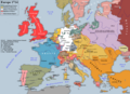
 Map of Europe (1714).png 998 × 801; 353 KB
-
 Ottoman Empire 1714.svg 450 × 456; 1.08 MB
-
 Poland-Lithuania 1714.svg 450 × 456; 880 KB

.jpg)
.jpg)


.png)

