Category:Maps showing 1786
Jump to navigation
Jump to search
| ← 1780 1782 1783 1784 1785 1786 1787 1788 1789→ |
English: Maps showing the year 1786 (i.e. history maps)
See also category: 1786 maps. and 1780s maps for old maps created in this time.
See also category: 1786 maps. and 1780s maps for old maps created in this time.
Media in category "Maps showing 1786"
The following 4 files are in this category, out of 4 total.
-
 8FranklinCounties.png 1,340 × 1,029; 210 KB
-
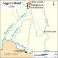 Logans Raid.png 3,083 × 3,083; 612 KB
-
 Map of Tennessee highlighting Former State of Franklin.png 1,024 × 251; 84 KB
-
 United States Central map 1784-05-12 to 1787-07-13.png 2,000 × 1,320; 249 KB


