Category:Maps showing 1815
Jump to navigation
Jump to search
| ← 1810 1811 1812 1813 1814 1815 1816 1817 1818 1819→ |
English: Maps showing the year 1815 (i.e. history maps)
See also category: 1815 maps. and 1810s maps for more maps showing this year usually created not long after the given year.
See also category: 1815 maps. and 1810s maps for more maps showing this year usually created not long after the given year.
Media in category "Maps showing 1815"
The following 3 files are in this category, out of 3 total.
-
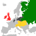 Map of the Quadrouple Alliance.png 2,021 × 2,048; 626 KB
-
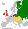 Map of the Quadruple Alliance (1815).svg 450 × 456; 709 KB
-
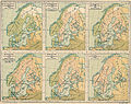 Skandinavien mellan 1397 och 1815.jpg 3,474 × 2,747; 3.45 MB

.svg)
