Category:Maps showing 1964
Jump to navigation
Jump to search
| ← 1960 1961 1962 1963 1964 1965 1966 1967 1968 1969→ |
English: Maps showing the year 1964 (i.e. history maps)
See also category: 1964 maps. and 1960s maps for more maps showing this year usually created not long after the given year.
See also category: 1964 maps. and 1960s maps for more maps showing this year usually created not long after the given year.
Subcategories
This category has only the following subcategory.
U
Media in category "Maps showing 1964"
The following 4 files are in this category, out of 4 total.
-
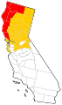 California Disaster Areas, 1964.svg 512 × 857; 741 KB
-
Evolution of United States standard time zone boundaries.webm 29 s, 3,507 × 2,480; 4.58 MB
-
 Tornado Watch 64.gif 525 × 459; 91 KB
-
 Toronto ward map 1964.PNG 625 × 533; 136 KB


