Category:Maps showing the 1340s
Jump to navigation
Jump to search
Subcategories
This category has the following 6 subcategories, out of 6 total.
- Maps showing 1340 (1 F)
- Maps showing 1345 (1 F)
- Maps showing 1346 (2 F)
- Maps showing 1347 (3 F)
- Maps showing 1349 (2 F)
Media in category "Maps showing the 1340s"
The following 11 files are in this category, out of 11 total.
-
 Diffusion de la peste noire 1347 1351.svg 966 × 1,167; 1.15 MB
-
 Difusió de la gran pesta a Europa.png 483 × 585; 128 KB
-
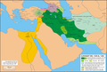 Ilkhan1339-1340.png 3,692 × 2,500; 1.17 MB
-
 Ilkhan1340-1341.png 3,692 × 2,500; 1.28 MB
-
 Ilkhan1341-1342.png 3,692 × 2,500; 1.18 MB
-
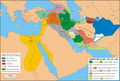
 Ilkhan1342-1343.png 3,695 × 2,500; 1.21 MB
-
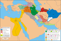
 Ilkhan1343-1349.png 3,693 × 2,500; 1.18 MB
-
 Ilkhan1349-1353.png 3,693 × 2,500; 1.22 MB
-
 South East Europe 1340.gif 1,113 × 854; 363 KB
-
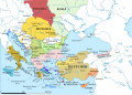
 South-eastern Europe 1340.jpg 1,122 × 870; 330 KB
-
 South-eastern Europe 1340.svg 2,086 × 1,483; 2.51 MB


