Category:Maps showing the 1550s
Jump to navigation
Jump to search
| Maps showing the 16th century:
←1500s 1510s 1520s 1530s 1540s 1550s 1560s 1570s 1580s 1590s → |
Not to be confused with maps made in the 1550s.
Subcategories
This category has the following 2 subcategories, out of 2 total.
Media in category "Maps showing the 1550s"
The following 4 files are in this category, out of 4 total.
-

-
 ChichimecNations.png 1,073 × 723; 139 KB
-
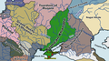 Crimean Khanate 1550.png 1,425 × 798; 247 KB
-
 Division of the House of Habsburg in 1556.jpg 1,152 × 812; 159 KB
.jpg)


