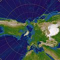
Category:Maps with gnomonic projection
Jump to navigation
Jump to search
English: This map-projection-related category exists in the following hierarchy:
- Category:Map projections
- Category:Maps by projection
- Category:Gnomonic projection – media related to the Gnomonic projection other than maps
- Category:Maps with gnomonic projection (“Category:gnomonic projections”) – maps made using the Gnomonic projection
Media in category "Maps with gnomonic projection"
The following 11 files are in this category, out of 11 total.
-
Admiralty Chart No 5096B South Attlantic and Southern Oceans Gnomonic, Published 1938.jpg 11,201 × 8,203; 20.87 MB
-
Gnom-kubus-uitgevouwen2.png 2,546 × 1,911; 501 KB
-
World borders gnom.png 2,000 × 2,000; 424 KB
-
Gnomonic Projection Japan.jpg 2,048 × 2,048; 1.06 MB
-
Gnomonic Projection Polar.jpg 2,048 × 2,048; 1.06 MB
-
Gnomonic projection SW.jpg 2,058 × 2,058; 1.1 MB
-
Gnomonic Projection Transversal.jpg 2,048 × 2,048; 984 KB
-
Gnomonic projection with Tissot's indicatrix centering 0°N 0°E.svg 3,600 × 3,600; 1.32 MB
-
Gnomonic with Tissot's Indicatrices of Distortion.svg 1,600 × 1,600; 558 KB
-
Gnomonische projectie Schiphol.PNG 597 × 599; 42 KB
-
Polyederprojectie-6-rendered.png 1,280 × 1,024; 704 KB


