Category:March 2007 in Cambridgeshire
Jump to navigation
Jump to search
Ceremonial counties of England: Bedfordshire · Berkshire · Buckinghamshire · Cambridgeshire · Cheshire · Cornwall · Cumbria · Derbyshire · Devon · Dorset · Durham · East Riding of Yorkshire · East Sussex · Essex · Gloucestershire · Greater London · Greater Manchester · Hampshire · Herefordshire · Hertfordshire · Isle of Wight · Kent · Lancashire · Leicestershire · Lincolnshire · Merseyside · Norfolk · North Yorkshire · Northamptonshire · Northumberland · Nottinghamshire · Oxfordshire · Rutland · Shropshire · Somerset · South Yorkshire · Staffordshire · Suffolk · Surrey · Tyne and Wear · Warwickshire · West Midlands · West Sussex · West Yorkshire · Wiltshire · Worcestershire
City-counties: Bristol ·
Former historic counties:
Other former counties:
City-counties: Bristol ·
Former historic counties:
Other former counties:
Deutsch: Bilder, die im März 2007 in Cambridgeshire aufgenommen worden sind. Bitte beachten Sie, dass dies weder das Datum des Uploads noch das Datum des Scannens eines Fotos ist.
English: Images/pictures taken in Cambridgeshire during March 2007. Note this is not the date of the upload, nor the date a photo was scanned.
Español: Fotografías o imágenes tomadas en Cambridgeshire durante marzo 2007. No es la fecha de subida ni escaneo, sino la fecha en que las fotografías o imágenes se crearon.
Esperanto: Bildoj faritaj en Cambridgeshire en marto 2007. Tio ne estas la dato, kiam la bildoj estis alŝutitaj aŭ skanitaj.
Français : Photographies ou images prises en Cambridgeshire durant mars 2007. Ce n'est pas la date du téléchargement ou du scan.
Galego: Fotografías ou imaxes tomadas en Cambridgeshire durante marzo 2007. Non é a data de subida nin escaneamento, senón a data na que se crearon as fotografías ou imaxes.
Italiano: Fotografie o immagini scattate a Cambridgeshire nel marzo 2007. Nota bene: la data non si riferisce né a quella di upload né a quella in cui la foto è stata digitalizzata.
Norsk bokmål: Bilder tatt i Cambridgeshire i løpet av mars 2007. Merk at dette ikke er datoen for opplasting, eller når et bilde har blitt skannet.
Norsk nynorsk: Bilete teke i Cambridgeshire i løpet av mars 2007. Merk at dette ikkje er datoen for opplasting, eller når eit bilete har vorte skanna.
Русский: Изображения, сделанные в Cambridgeshire в течение март 2007 (не дата загрузки изображения).
Українська: Зображення, зроблені в Cambridgeshire протягом березень 2007. Зауважте, що це не дата завантаження чи дата сканування фотографії.
| March 2006 | ← | March 2007 | → | March 2008 | |||||||
| Jan | Feb | Mar | Apr | May | Jun | Jul | Aug | Sep | Oct | Nov | Dec |
| 5 | 33 | 39 | 33 | 35 | 48 | 22 | 22 | 22 | 32 | 16 | 31 |
|---|---|---|---|---|---|---|---|---|---|---|---|
Media in category "March 2007 in Cambridgeshire"
The following 39 files are in this category, out of 39 total.
-
 The Fort St George, Midsummer Common - geograph.org.uk - 797800.jpg 640 × 480; 116 KB
-
 A corner of Northamptonshire - geograph.org.uk - 378240.jpg 640 × 480; 136 KB
-
 The Anchor Inn at Sutton Gault - geograph.org.uk - 355321.jpg 640 × 440; 54 KB
-
 Bridge At Sutton Gault - geograph.org.uk - 355327.jpg 640 × 335; 44 KB
-
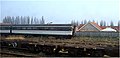
 Cambridge Station and Spiller's Mill - geograph.org.uk - 1779370.jpg 1,024 × 744; 814 KB
-
 Dismantled bridge - geograph.org.uk - 371501.jpg 636 × 441; 79 KB
-
 Disused railway near Burwell - geograph.org.uk - 363437.jpg 427 × 640; 60 KB
-
 Disused station from bridge on A1198 - geograph.org.uk - 371516.jpg 636 × 435; 61 KB
-

-
 Farmland - geograph.org.uk - 382645.jpg 640 × 481; 70 KB
-
 Farmland - geograph.org.uk - 382647.jpg 640 × 481; 72 KB
-
 Farmland - geograph.org.uk - 382652.jpg 640 × 481; 56 KB
-
 Fifty Acre Allotment, Sutton Gault - geograph.org.uk - 378754.jpg 640 × 427; 67 KB
-
 Flooded Road Sutton Gault - geograph.org.uk - 355332.jpg 640 × 479; 133 KB
-
 Footpath to Potton - geograph.org.uk - 382638.jpg 640 × 481; 43 KB
-

-

-
-
 Kingsway Flats, Arbury, Cambridge - geograph.org.uk - 357653.jpg 640 × 480; 107 KB
-
 Lineside hut on disused railway - geograph.org.uk - 371499.jpg 638 × 446; 66 KB
-
 Old Bedford River at Sutton Gault - geograph.org.uk - 378753.jpg 640 × 427; 73 KB
-
 Old railway bridge on A1198 - geograph.org.uk - 371513.jpg 637 × 436; 54 KB
-
 Old railway bridge outside Gamlingay - geograph.org.uk - 371805.jpg 636 × 428; 82 KB
-
 Old railway embankment - geograph.org.uk - 371500.jpg 640 × 169; 25 KB
-
 Old railway track, north of Wisbech - geograph.org.uk - 360063.jpg 480 × 640; 249 KB
-
 River front at Ely - geograph.org.uk - 385707.jpg 640 × 480; 62 KB
-
 St Mary's St, Ely - geograph.org.uk - 357001.jpg 640 × 483; 188 KB
-
 St. John's Playing Field (north half).jpg 2,816 × 2,112; 2.17 MB
-
 Steep on a bike^ - geograph.org.uk - 382650.jpg 640 × 481; 46 KB
-
 Sutton Meadlands - geograph.org.uk - 378749.jpg 640 × 427; 60 KB
-
 Sutton Meadlands - geograph.org.uk - 378751.jpg 640 × 427; 58 KB
-
 Towards the A14 - geograph.org.uk - 358516.jpg 640 × 427; 58 KB
-
 Track to stables, Eyebury Road, Eye - geograph.org.uk - 354196.jpg 640 × 428; 153 KB
-
 View towards Ely Cathedral - geograph.org.uk - 385716.jpg 640 × 480; 70 KB
-
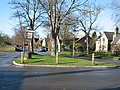 Village sign and lamp, Newton, Cambs - geograph.org.uk - 355400.jpg 640 × 480; 404 KB
-

-
 Wires, wires, wires - geograph.org.uk - 358513.jpg 640 × 427; 61 KB
-
 Village sign, Newton, Cambs - geograph.org.uk - 355404.jpg 299 × 640; 278 KB
-
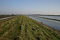
 Winter flood at Moretons Leam - geograph.org.uk - 361376.jpg 640 × 480; 80 KB


.jpg)


